Across the Mississippi

Across the Mississippi © 2010 Bo Mackison

Once I cross the Mississippi, I know it’s true.

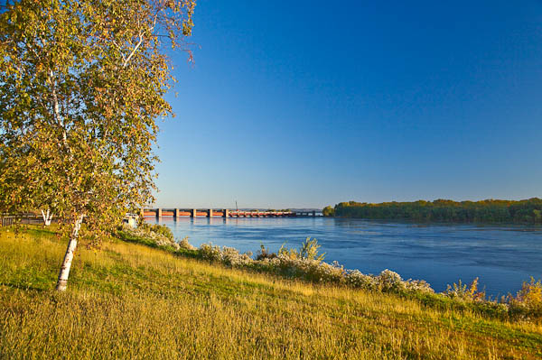
It’s time for another trip to the land I love to visit – the western and southwestern regions of the United States. We crossed the Mississippi just after sunrise, and the sunlight made that Minnesota shore sparkle like gold.

That’s Lock and Dam #5 – located on Mississippi River about ten miles northwest of Winona, Minnesota. It was built in 1935 and underwent major renovation in 1987-98. The locks and dams control the flow of the Mississippi.

From its origin to St. Louis, the Mississippi is controlled by 43 dams. Fourteen of these dams are located above Minneapolis in the headwaters region and generate electrical power and provide a great recreational resource. The other 29 dams start in downtown Minneapolis and contain locks which were constructed to permit commercial navigation of the upper river.

These 43 dams shape the geography of this huge river, the largest river system in the United States. The length of the Mississippi, from its origin in Lake Itasca, Minnesota to where it flows into the Gulf of Mexico 50 miles south of New Orleans is about 2,320 miles.

I lived in a river city on the Mississippi for the first 18 years of my life, and I’ve always lived in a state that borders the river, so I consider the Mississippi “my” river.
High Waters

Lifeguard Station - No Swimming during Flood

Lifeguard Station – No Swimming during Flood ©2008 Bo Mackison

Weather. 2008 has already given us enough crazy weather, and there seems to be no end in sight. Usually by mid-June, we have been on the Madison lakes for six weeks – fishing, boating, tubing. But this year has been unusual, weather-wise. First a crazy winter with a record breaking 100+ inches of snow, then a spring that didn’t arrive until the end of April, and now so much rain and flooding that the Madison lakes are effectively closed for recreation.

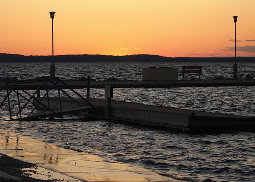
Lake Mendota - Sun Setting on Flooding

Lifeguard Station – No Swimming during Flood ©2008 Bo Mackison

Boats are still allowed on the lakes, but the entire chain of lakes is under a “no-wake zone.” The swimming areas and beaches is usually filled with people by now, but no one is playing in the water these days and the beaches are all underwater. I’m not complaining, though. I may be inconvenienced, but that is all. In Madison, most of us are counting our blessings and keeping our fingers crossed.

On a slightly different note, the Mississippi River is expected to crest on Friday in my hometown – Quincy, IL. The bridge is closed heading into Missouri there, and at numerous other sites connecting the states of Iowa, Illinois and Missouri. In Quincy, people have come from around the country to help fill more than 750,000 sandbags. These bags are surrounding levees and threatened utilities. The water treatment plant is surrounded by thousands of these sandbags and people are praying they will hold back the river. If they don’t, Quincy residents have access to three days worth of city water. Then the city of 45,000 would have to rely on bottled water.

One man brought his teenage children to Quincy this week from Colorado Springs, Colorado to fill sandbags. He said he wanted them to have the experience of helping others who are dealing with a natural disaster of this proportion. College students who attend area schools have returned to many river communities from their Chicago homes to help sandbag the levees. 300 Amish from the Amana Colonies in Iowa are helping. The National Guard is there sandbagging and providing needed services.

It’s heartening to hear the many people coming together to help each another. The Red Cross and other agencies are providing needed services and are asking for all the help they can get.

A big thank you to everyone who making an effort and making a difference.

***

As of 1 pm: 4 levees have broken, farms and houses flooded for 25 miles south of Quincy. The water treatment plant is still open.