Crossing Colorado

Black Canyon National Park

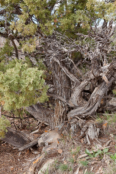
Juniper High Above Black Canyon © 2013 Bo Mackison

The Fourth Day – East Across Colorado

A half-dozen times I’ve circled Black Canyon National Park on vacation maps
and a half-dozen times we lingered too long at Arches or Canyonlands,
and Black Canyon was scratched. Who even knows there is such a place as
Black Canyon of the Gunnison National Park anyway?

Now you can count me among its visitors, I’ll keep its secret.
Here are steep cliffs, ancient rock, craggy spires,
and walls streaked with dragon outlines, erosion’s art work
on rocky canvas 2000 feet from flowing river to cliff edge.

Black Canyon National Park

Black Canyon National Park © 2013 Bo Mackison

Oh, the quiet places, open spaces, vertical wilderness
shared with soaring hawks and eagles.
Cloud cover kept the canyon in shadow, but the river’s song
sounded on the high mesa and wildflowers bloomed
in the roots of twisted junipers.

Twenty years getting here and I had only half a day
to see what I had missed, a half day to know I’ll return.
When the wind gusts spiked at 50 mph, I knew I’d pushed my luck,
but a tail wind pushed me half-way across Colorado.

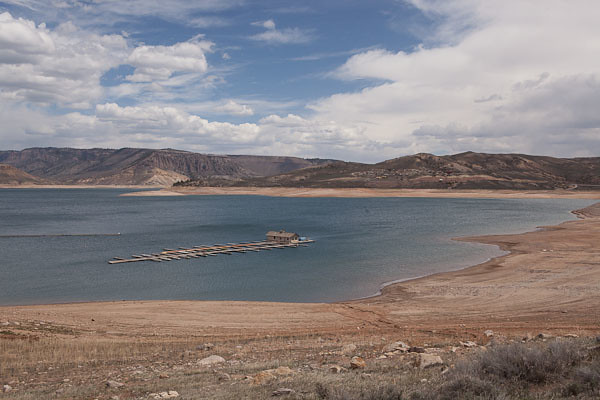
Stranded Boat Dock - Curecanti NRA

Stranded Boat Dock © 2013 Bo Mackison

Colorado has fine scenery, but those low gray clouds packed with snowy potential
overwhelmed my yearn to pull over and explore.
Still, there was plenty to see –
the up and down rhythm of mountain, valley, mountain.
Tumbleweeds skirted the highways.

Cimarron, Colorado. Conjurer of Wild West.
Lakes half filled, driftwood sculptures lace the sandy edges.
And colors bleached by winter’s touch take on color — 
greening grasses, tree twigs in muted yellows, pinks, rusty reds,
Weeping willows in yellow-green tangles.
Calves snooze in muddy pastures,
content as their mothers graze nearby.

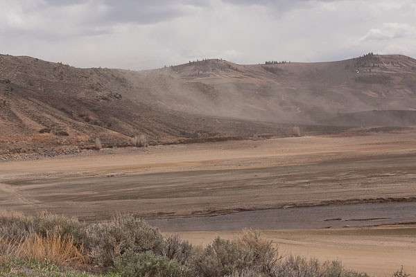
Dust Storm at Curecanti NRA

Dust Storm at Curecanti © 2013 Bo Mackison

Dust clouds swirl around my car at Curecanti.
I stop at another ranger station,
it’s a slow day for recreation, the staff ply me with coffee, maps,
highlight the safest route through the eastern mountain passes.
Another hawk sweeps past my car, hawks are my companion bird this trip.

San Isabel National Forest.
Steepy Mountain.
And then Monarch Pass. Fitting, Monarch is the pass to bid me farewell
as I cross the Continental Divide and head towards the plains.

Salida and a stop at Sally’s Cafe for coffee.
The road follows the Arkansas River,
running with spring melt, thunder-crashing into protruding red rock.
Fly fishermen queue for prime locations.

In the high desert town of Cañon City
I watch the last hawk of the day —
dancing, sky diving, it welcomes the evening.

———

Bo Mackison is a photographer and owner of Seeded Earth Studio LLC. A cross-country traveler by day, and an occasional poet. This is a poem in nine parts, because the trip lasts nine days. This is day four!
Bricks and Passages

Mesa Verde National Park - Visitor Center

Love the Stripes at Mesa Verde Visitor Center © 2013 Bo Mackison

Day Three – A Colorado Day

37˚ at 5:40 am, I unpack the trunk to find my sweatshirts,
truckers start their engines and let them idle over breakfast
the couple in the next room search for their car keys.
Back and forth bickering, truck fumes. I grab my coffee
and a couple of hard-boiled eggs and pull onto the highway as the sun rises.

Mesa Verde National Park is only minutes east, and the new visitor center
receives last-minute grooming for a Memorial Day Grand Opening,
I overlook the bright exhibits on prehistoric dwellings and pottery,
my attention captured by dizzying stripes of light/shadow,
building, bricks, benches, steps.
Each stripe marks my time, passage on a sunlit day.

I follow the self-guided tour of Spruce House,
an Ancestral Pueblo dwelling abandoned in A.D. 1300.
Imagine life on the edge of a rock cliff with toddlers and elders,
and give thanks for the salad and iced tea I order from the Spruce Tree Cafe.

I meander through the gift shop, the museum, explore the ancient diorama,
and leave Mesa Verde — Green Table — hours later than planned.

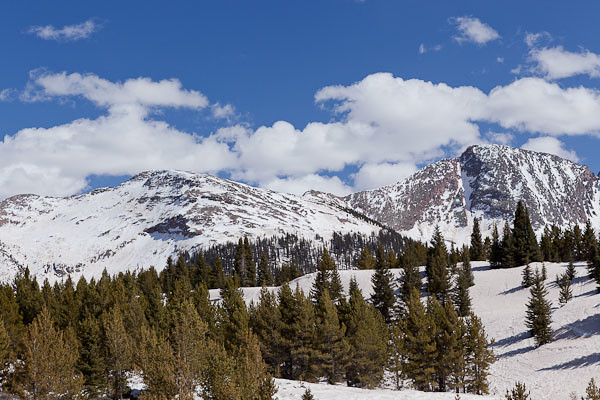
Colorado Mountains

Spring Melt in Colorado Mountains © 2013 Bo Mackison

Durango is a city I yearn to explore, park my car, walk the streets,
peer in the galleries and visit the breweries, perhaps next year.
Deer and elk crossings, lights flash red and yellow,
I head out-of-town on Colorado 550.
Later I read there are 638 mountains in the Rockies over 13,000 feet.
I won’t claim – neck craned, muscles in spasm – that I saw all those peaks,
but I saw enough for one day.

It is spring thaw, the melt flows over the roads,
waterfalls course along the sheer rock walls, mini avalanches slide across the two-lane road
and snow plows patrol the passes. The scenery is mesmerizing,
I stop at the pullouts constantly as I don’t chance a glance while driving
these no-guard-rail curves and to let my courage catch up to task ahead.

Ribbons of rocky earth alternate with snow pack on the peaks,
stands of fir poke sharp greens into the blue skies,
clouds that peek over the mountain tops are
white as white – glaring white, brilliant white, white of purity.

The high country ponds are frozen and
roads to summer retreats with inviting names are still impassable,
hidden from civilization. Some aspen are greening,
and black tooth-pick lodge pole remnants
stand as reminders of the Missionary Fire of 2002.

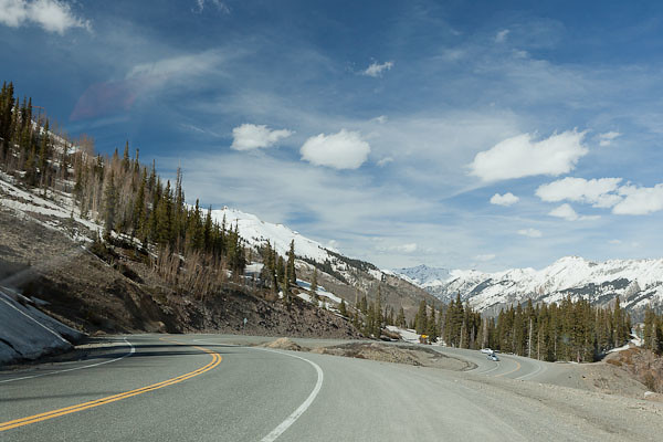
Hairpin Curve on Highway 550, Colorado

Hairpin Curve on Highway 550 © 2013 Bo Mackison

A hawk’s shadow crosses the road and glides towards the San Juan Mountains.
Coal Bank Pass 10648 feet.
Hairpin turn at Lime Creek.
Molas Pass 10910 feet.
Sultan Creek.
The Colorado Trail.
Silverton.

Red Mountain Pass 11,108 feet.
Road as slalom, blinking avalanche warning signs,
rock slide mitigation crews clear the road,
we alternate driving the cleared lane which hugs earth, drops into sky.

It is still breathtakingly beautiful.
I practice deep breathing techniques. To calm my racing heart or to increase my oxygen levels?
No matter. I descend into Ouray, and follow the Uncompahgre River,
frothy brown and wild, into the valley.

The next morning, a jovial park ranger and I speak of Colorado 550,
“yeah, highest passes, drop-offs, most difficult maintained road in the state.
Maybe in the country. You drive that, you drive anything.”

Perhaps he was being kind in his attempt to legitimize my feat of courage.
I smiled and nodded. I accepted his announcement as truth.

————-

Bo Mackison is a photographer and owner of Seeded Earth Studio LLC. A cross-country traveler by day, and an occasional poet. This is a poem in nine parts, because the trip lasts nine days.

Crossing State Lines

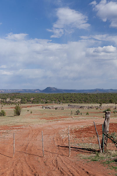
Mountain Ranch

Red Earth, Blue Skies © 2013 Bo Mackison

On Sunday, the Second Day

On the day I travel from mountains to plains,
I cross the state line, and sing-song
“Goodbye, Arizona; Hello, New Mexico.”

I keep my place on the map by noting the washes I cross,
Federal highway signs break the monotony of the endless I-system.
Querino Wash, dusty and dry,
Carr Lake Wash, dusty and dry.
Meandering water gives the Little Colorado River’s name veracity.
Rivers most commonly run dry in the Southwest
and imagination replaces river-water.

I turn north, follow the Trail of the Ancients, Navajo Nation,
Cinder block homes and sweat lodges. Horses stand in the shade of ramadas.
Winds blow fierce, flying dust covers the road,
I steer my car by the tracks of the pick-up truck ahead
and rocks rise in mystery from a nothingness, silhouettes in swirling dust.

Near Shiprock, NM – yes, a rock clipper ship rises from the plateau –
a wailing dog circles its dead companion rigid on the roadside,
nudges the head matted with dark stained dirt.

Briefly I think of Sunday School Bible verse contests,

“For you were made from dust, and to dust you shall return,”
but I prefer the astronomer’s explanation –
“You are star-dust, the heart of the star.”

Towards evening I reach Four Corners, a geographical nameplace
Arizona, New Mexico, Utah, Colorado touch with 90˚ precision,
An accuracy of borders esteemed by politicians and mapmakers.

I choose to pass the concrete historical marker
and the surrounding neon-lit gift shops,
intent, instead, on reaching my destination before nightfall.

————-

Bo Mackison is a photographer and owner of Seeded Earth Studio LLC. A cross-country traveler by day, and an occasional poet, — this is a poem in nine parts, because the trip lasts nine days. Day One is here.

Painted Desert Inn

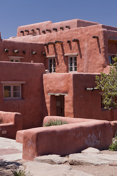
Painted Desert Inn

Window in Adobe © 2013 Bo Mackison

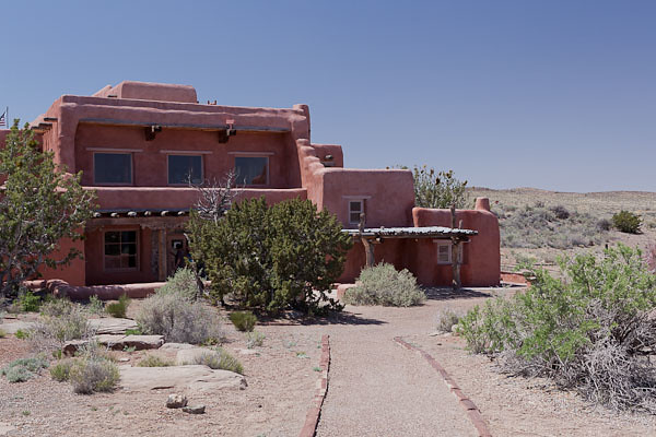
The Painted Desert Inn is within the boundaries of the Petrified Forest National Park and on the original Route 66. It is situated high on a mesa overlooking the Painted Desert.

Painted Desert Inn

Painted Desert Inn © 2013 Bo Mackison

Built in the early 1920s by Herbert D. Lore, it offered lodging and dining in a remote setting on the Colorado Plateau. Purchased by the National Park Service in 1935, it underwent extensive remodeling under the supervision of architect Lyle Bennett. Men in the Civilian Conservation Corps (CCC) did much of the labor.

Painted Desert Inn

Painted Desert Inn © 2013 Bo Mackison

The building’s red-stucco, stone walls are more than two feet thick. Multiple layers, flat roofs with Ponderosa Pine beams, and flagstone courtyards add great character and the high desert sunlight offers contrast between light and shadow.

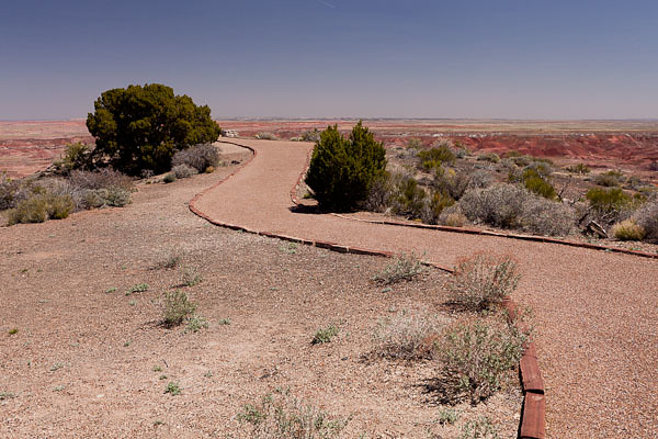
Outlook Path at Painted Desert Inn

Outlook Path at Painted Desert Inn © 2013 Bo Mackison

Imagine being a visitor to the lodge in the early 1940s. A traveler could get lodging, meals, souvenirs…and an unforgettable view of the setting sun from this overlook point at the rear of the building.

(The inn was restored in 2006 to look as it did in 1946. It is now a museum and a National Historic Landmark.)

——————

Bo Mackison is a photographer and owner of Seeded Earth Studio LLC.    As she travels cross-country, she is visiting National Parks and Monuments on her route.


Crossing the Country

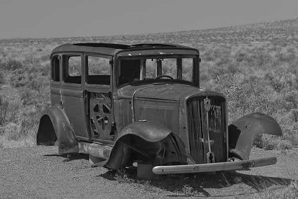
Car on Historic Route 66

Old Car © 2013 Bo Mackison

“Travel is more than the seeing of sights; it is a change that goes on, deep and permanent, in the ideas of living.”
~ Miriam Beard

Saturday:

It is sunny and 71˚ and 8:03 a.m. when I lock the door,
jam my last bag in the car.
No need to memorize the blue of the sky, it is already mine.
A red tail hawk dips into the arroyo,
I catch his wide sweep as I turn north.
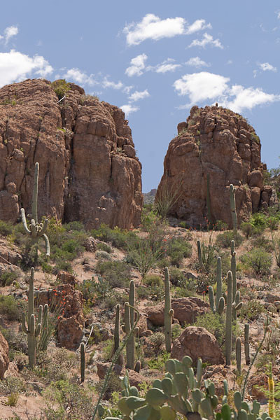
Prickly pears and yucca bloom extravagantly,
Spent blossoms of the ocotillo litter the curbside.

In three hours I have detoured twice,
a little lost, I follow Arizona Scenic Highway signs
like dropped bread crumbs in a dark forest,
curve along the edges of copper mines,
open pits of rock, miners in yellow hard hats maneuver
front-loaders along the narrow ledges.

Boyce Thompson Arboretum State Park

Boyce Thompson Arboretum © 2013 Bo Mackison

I walk the paths of the arboretum at noon,
detour through Miami’s mission district at three,
at four I descend into the Salt River Canyon.
Hawks soar high above the road, I follow their shadows on the asphalt.
Red Tails are my trip totem,
Road cuts expose the white rock of the White Mountains,
Vines and creeping flowers line the rough rock.

5:02 p.m. and I stop in Show Low,
the motel is on Deuce of Clubs Street, the main drag.
Can’t show lower than the deuce of clubs.

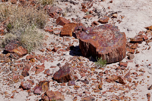
Scattered Petrified Wood

Scattered Petrified Wood © 2013 Bo Mackison

Sunday morning:

Gas at Safeway is 3.42 a gallon,
two fishermen lean against their truck, boat in tow,
and argue about late starts and wasted time.
The older guy draws on his cigarette while pumping gas.

North of Show Low the topography is Illinois flat,
the soil is Utah red.
Dead River.
Querino Wash.
Four Mile Draw, Five Mile Draw, Six Mile Draw.
Godawful flat and dusty,
Telephone poles are distraction.

Past Holbrook, outcroppings jut like layers of floor sheeting.
It’s a land of rock, a many-layered fossil cake in rainbow hues.
Entrance signs greet and command:
“Welcome to Petrified Forest National Park.
Do Not Remove Rocks Under Penalty of Law.”
I take only photographs.

———-

Bo Mackison is a photographer and owner of Seeded Earth Studio LLC. A cross-country traveler by day, and an occasional poet in the evening.