Chiricahua and Beyond – Day 1

Attachment-1-1

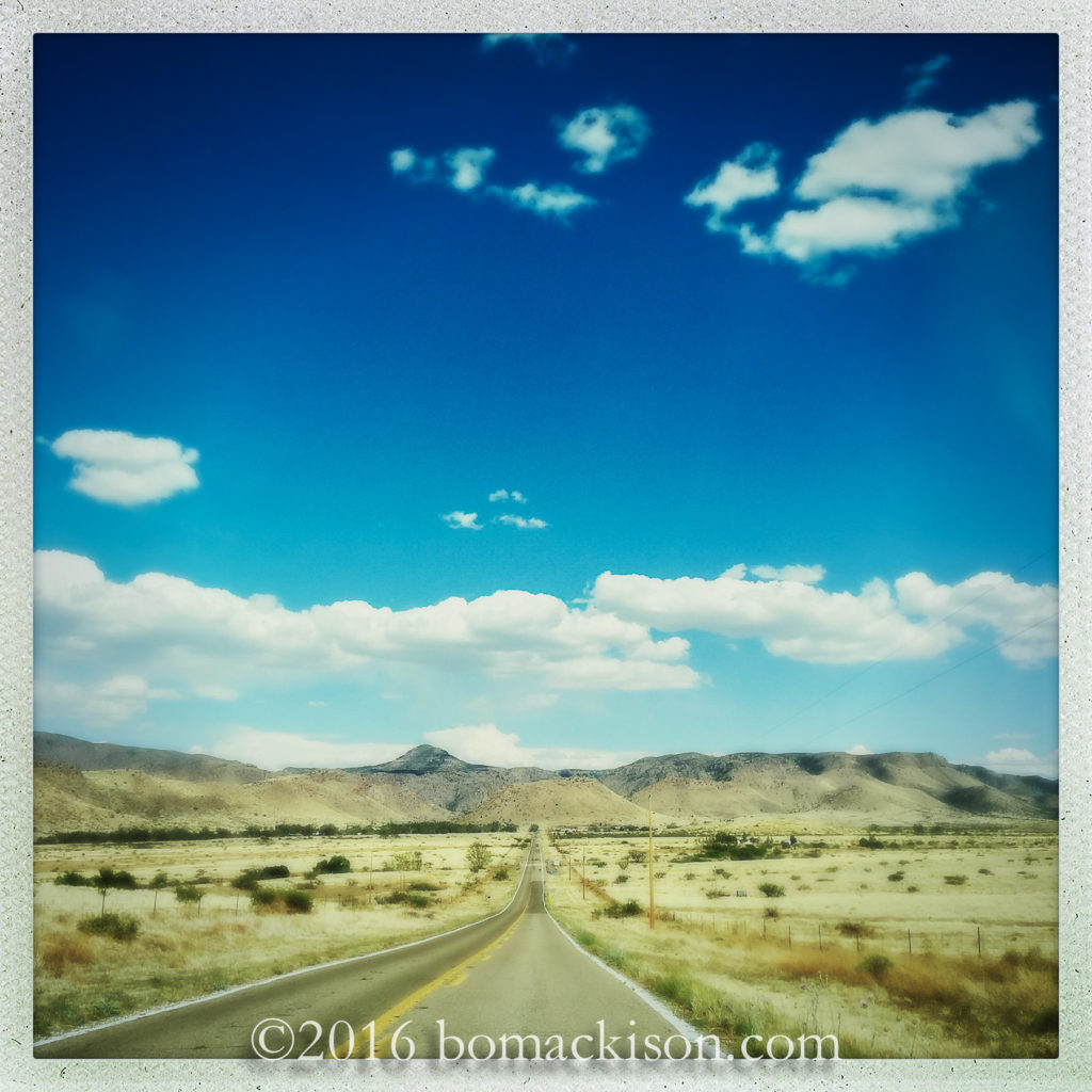
Drive east across southern Arizona
veer southeast at Willcox
and cross the high desert.
Attachment-1-2

Here are the Chiricahua Mountains, a sky island,
and Chiricahua National Monument.
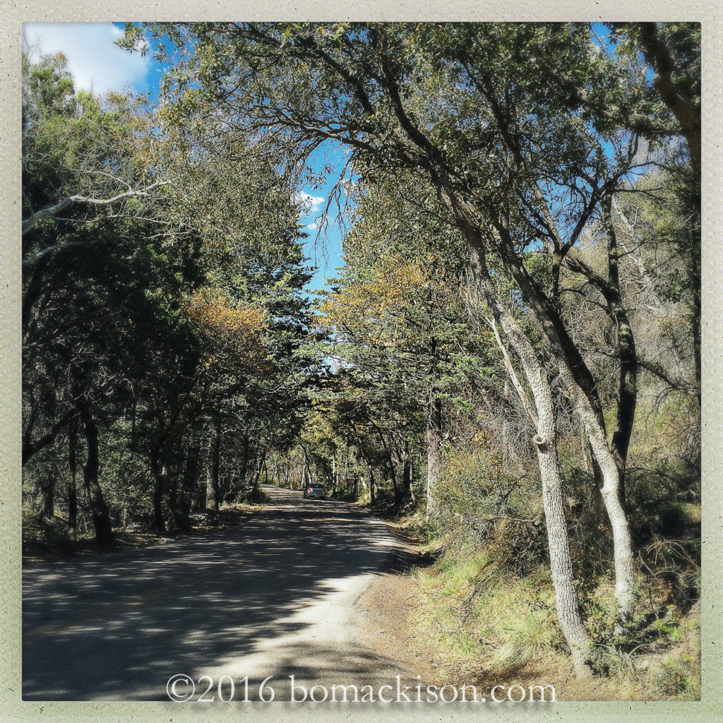
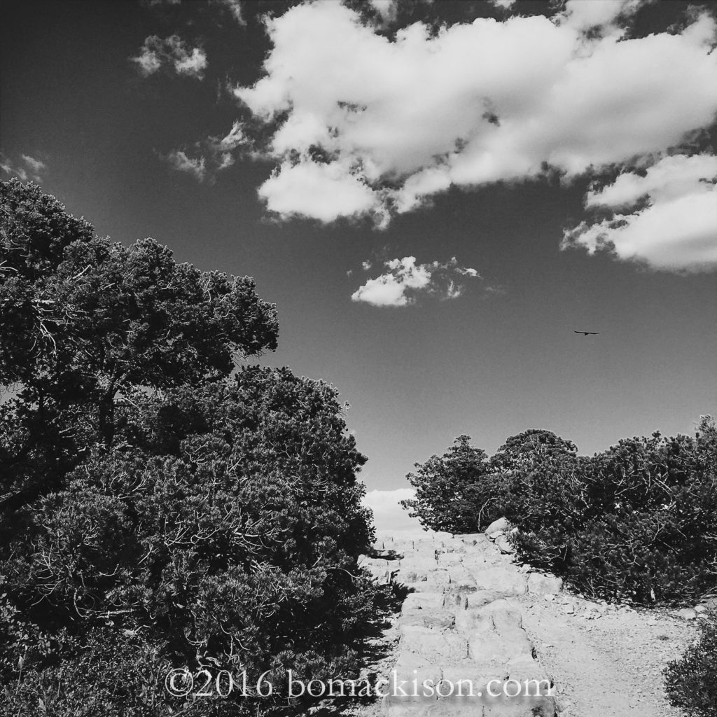
Begin in the mixed oak and conifer forest and
Attachment-1-5

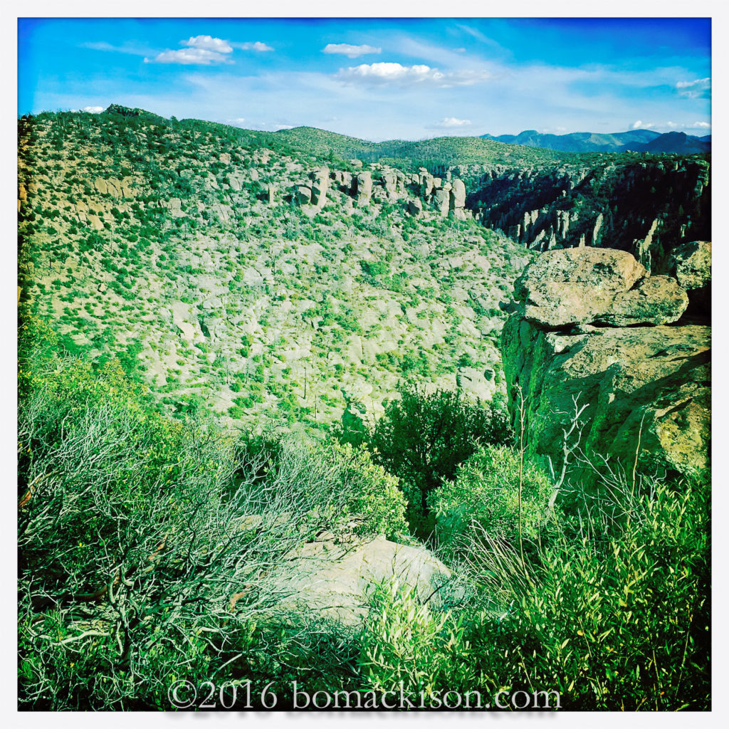
ascend 6000 feet, finish amidst the highest rocks,
Chiracahua Peak is 9,759 feet high.
An Apache place name, it  means “a wonderland of rocks”.
Attachment-1-4

The rocks are rhyolite, volcanic rock,
the trees are juniper, pygmy trees,
and the Chiricahuan Raven calls this mountain his home.
Attachment-1-9

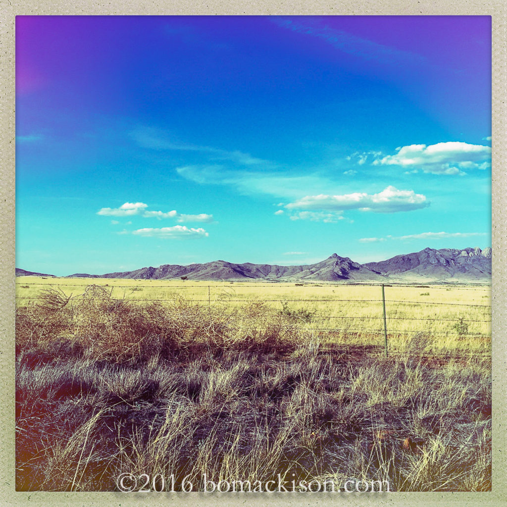
Return the way one came, descending Bonita Canyon Road,
and return to the high desert.
The tumbleweed blow. A storm approaches.
Attachment-1-8

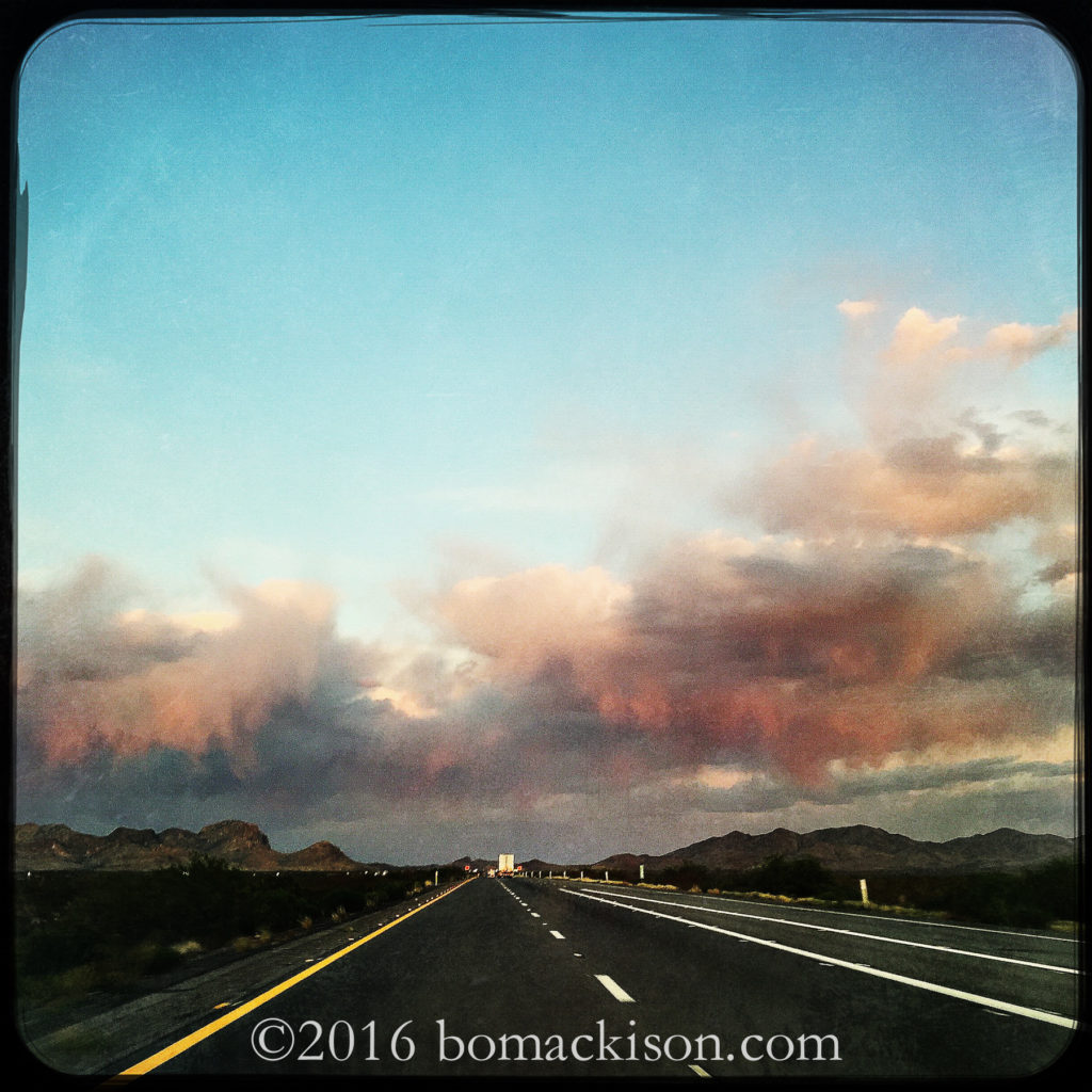
Drive east again, towards New Mexico,
the first day of travel nearly done.
The air so dry and hot, the rain evaporates before it reaches the ground.

~~~~~~

Cross country travel. Using iPhone and Hipstamatic app. There is little time to stop for photographs, so these are on-the-road shots.
Desert Poppies – A Poem

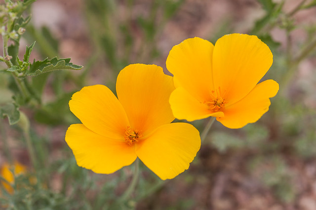
Golden Desert Poppies

Desert Poppies © 2013 Bo Mackison

Notice how present a flower is, how surrendered to life. ~ Eckhart Tolle

It is a beautiful place, this desert.

Hard to imagine its fullness of life, its diversity
until I explored her land each day.

Tread on mountain paths lightly frosted in mid winter
scrambled into washes torn asunder by summer flash floods.
Walked her rocky trails aware of each footfall,
threaded my way through deep crevice mazes.

I reach towards a saguaro to steady my balance
only to pull back in mild shock
imagining my hand pierced with the spines of a saguaro.

I stand in her washes in spring, the desert in her blossoming season,
admire the waving yellow poppies, their throats flushed with red,
their roots grounded in a chaos of rock and grit,
their silken petals a delicate offering amidst so much ruggedness.

—————-

Oh the places, the spaces in the desert; the discoveries, the inspiration in the desert.

Bird Life in the Desert


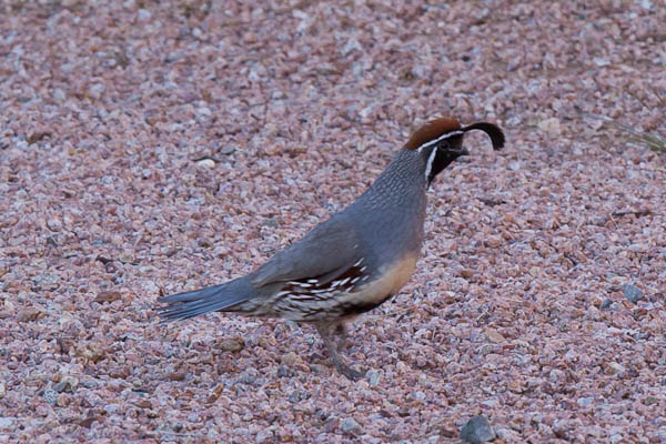
Gambel's Quail ©2016 Bo Mackison

Gambel’s Quail ©2016 Bo Mackison

I wonder at my daily sightings of the mama
and papa quail, their brood of chicks dart
like scattered billiards balls, each pecks
for seeds in the rocky soil.

On hot afternoons the adults settle into
the desert earth like ancient ocean puffer balls,
keeping watch, the chicks tucked under
a prickly pear cactus hideout.


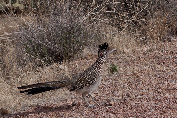
Road Runner © 2016 Bo Mackison

Road Runner © 2016 Bo Mackison

He has the habits of a slap stick comedian,
a relative of acclaimed characters in
Western tall tales & Saturday morning cartoons.

I’ve seen him do a helicopter dance,
land with a bird in his beak.
He’ll do combat with a rattler…and win.

And yet in courting, he presents his intended
with a twig or blade of grass,
then the chase is on — ’til she decides yea or nay.

On cool desert mornings he spreads
his tail feathers, exposes dark flesh,
& warms himself with the heat of the sun.
An energy conservationist.

Opening to the Sacred – A Poem

Wupatki - Finding the Open Spaces

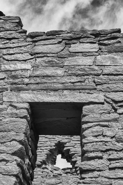
Opening to the Sacred © 2014 Bo Mackison

A poem is . . . an act of devotion and holy rebellion; a source of healing and a journey of risk. ~ Edveeje Fairchild

I enter emboldened.

I come in holy rebellion.

Enough groveling at feet of stone-struck statues
incapable of emotions, no welcoming nod,
refusing to utter soothing words as balm to my aching heart
or offer celestial embrace.

You.
Safe behind barred doors,
chain link fences,
security-guards on watch.

From whom do you seek protection?

The penitent, the silenced one, the hesitant seeker?

I rise in holy rebellion.
I will not bow nor cover my face with
a black mantilla and your rules.

I do not come in holy rebellion.

I am Holy Rebellion!

On The Road to Why — A Poem

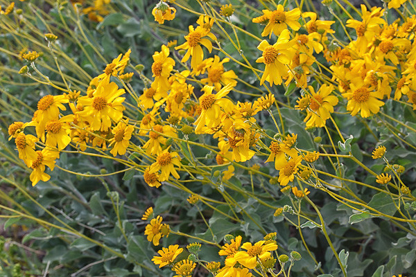
Brittlebush

Brittlebush © 2013 Bo Mackison

It is good to have an end to journey toward; but it is the journey that matters, in the end. ~ Ernest Hemingway

Checking the map, 112 miles to Why, then south to Organ Pipe Cactus National Monument.
Highway 86, Ajo Highway, I head west on the road of roadside memorials
and shrines, over a hundred I photographed a few years ago.

I travel through urban sprawl, then open space.
Silver Star Road, brown earth, barbed wire fences.
Robles Junction.
Water puddles in the irrigated fields at Buckelew Farms.

Fuller Road. Battered mailboxes along the road, a row of scraped paint,
crushed metal, gunshot holes and red flags.
Where are the shrines and crosses? They’ve disappeared.
Scraped off the desert earth.

Kitt Mountain is due west, dotted with white observatories,
celestial connections on the highest peaks.
Telephone poles string across the desert scrub. Earthly connections.

Tucson Rifle Club. Members Only.
Hayhook Ranch Road. Ranch For Sale.
Watch For Animals Next 54 Miles.

Yellow bundles of brittlebush and desert marigolds crowd the median strip.
Gravel piles stands where once there were roadside memorials,
the adjacent desert has been scraped level for a road widening project.

A bush of orange mallow, waving stalks of purple pestomen,
white sacred datura, like bridal bouquets dropped along the road.
Tohono O’odham Nation. Green desert, red earth.

San Pedro Road. Coyote Trading Store, open for business no gas.
Asphalt shoulders, graded hills with rolls of burlap hold back the earth.
Where are the memorials? Relocated? Destroyed?

Pan Tak Road
Kitt Peak Ahead, Turn Left
Road construction Expect delays

The road is wide, the shoulders wide,
and safer for the driving living.
Fewer memorials on the side of the road.

Saguaros relocated from the easement, twenty feet tall, propped with 2 by 4s.
By law, saguaros must be relocated.
A saguaro must face its original direction, or it will die,
and become another road casualty.

Gouged earth. One giant saguaro still stands
upon the graded bank, its roots exposed and twisted in the air.
Yellow earth movers shovel the ancient earth into piles.

This is progress. A safe road is a good road.
A good road is a safe road.
Smooth and homogenized, the desert tamed.

Three hawks soar high. Far enough west, the road narrows.
Red plastic ribbons flutter from branches marked for the bulldozer.
But for now grasses encroach over the yellow lines.
Mesquite and tree cholla crowd the roadside.

8602929371_775514d47a_o

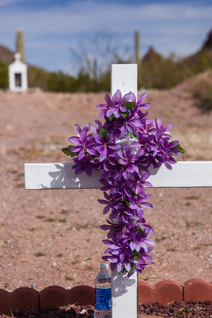
A single white cross remains, decorated with bright flowers.
The peak of Baboquivari, I’itoi’s sacred mountain, pierces the desertscape.
Border Patrol. Their green-striped white truck is parked
under a mesquite while they search the scrub.

Littering Unlawful
You Are Entering Sells, Arizona, Population 2734
Komkcʼeḍ ʼe-Wa:ʼosidk, Capital of the Tohono O’odham Nation
The O’odham name means Tortoise Got Wedged.

Indian Oasis School Baboquivari District

Watch For Animals Next 10 Miles
Papago Assembly of God

Highway 19 Junction, Hospital Here
The Shell gas station pumps regular for 3.47.
Two wild horses, white and shaggy, graze along the road,
unperturbed by passing trucks.

Eugene Tashquinth Livestock Complex hosts
76th Annual Tohono O’odham Rodeo
January 26 – February 4, 2014

Tree cholla forest.
Yellow flowering mesquite, seed beans swing in midday breeze.
Road to Nolia. Turkey vultures. Triple decker saguaro.

Quijotoa. A historical marker tells me
it is Papago for Mountain Shaped Like a Carrying Basket.
Carrying Basket had pockets of gold and silver.
And a mining boom in 1883.

Ghost towns. Logan City, New Virginia, Brooklyn, Allen City,
there was only a small pocket of precious metal.
The desert reclaims the abandoned.

Highway 15 Junction to Santa Rosa Casa Grande.
Desert sprawl, yellow blossoming brittlebush color the cactus floor.
The road narrows, ocotillo arch over the pavement. Toothpick saguaros.
Quijotoa Pentecostal Church of God.

Red and purple bows tied to mesquite branches,
remaining traces of a roadside memorial.
The dirt is leveled, the pull-off blocked with a rock pile.

Flashing lights on a Park Ranger’s truck slow oncoming traffic.
Three teen runners jog in the truck’s exhaust fumes,
one carries a banner. Unity Runners.

Road to Pisinemo.
San Si:mon. Tohono O’odham High School.
San Simon Health Center.

Flash Flood Area Next 10 Miles
Why 18 miles. Ajo 28 miles
Chain cholla glitter silver in the sun.

HIWAYRVPRK next road. Shuck Toak Road
Desert Diamond Casino, asphalt parking lot.
Coyote Howl RV Park. Abandoned.

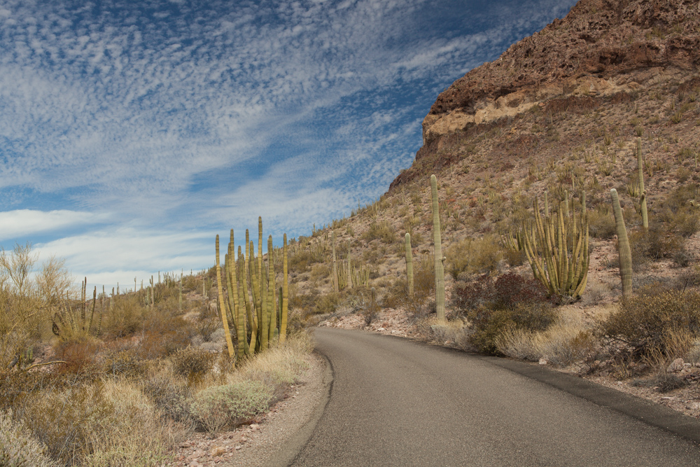
Road in Organ Pipe Cactus National Monument ©2016 Bo Mackison

Road in Organ Pipe Cactus National Monument ©2016 Bo Mackison

Highway Junction 86/85
Lukeville 27 miles. 10 miles to Ajo
Approaching Organ Pipe Cactus National Monument, A Biosphere Reserve

12:46 pm. March 18. 86˚F.
Blue skies. Windy.
Relentless sun bleaches color from the desert.

The organ pipes loom tall,
massive and thick, multi-armed.
Alien. Grotesque. Beautiful.

~~~~~~~

Not so much a poem, more a travel log.