Bricks and Passages

Mesa Verde National Park - Visitor Center

Love the Stripes at Mesa Verde Visitor Center © 2013 Bo Mackison

Day Three – A Colorado Day

37˚ at 5:40 am, I unpack the trunk to find my sweatshirts,
truckers start their engines and let them idle over breakfast
the couple in the next room search for their car keys.
Back and forth bickering, truck fumes. I grab my coffee
and a couple of hard-boiled eggs and pull onto the highway as the sun rises.

Mesa Verde National Park is only minutes east, and the new visitor center
receives last-minute grooming for a Memorial Day Grand Opening,
I overlook the bright exhibits on prehistoric dwellings and pottery,
my attention captured by dizzying stripes of light/shadow,
building, bricks, benches, steps.
Each stripe marks my time, passage on a sunlit day.

I follow the self-guided tour of Spruce House,
an Ancestral Pueblo dwelling abandoned in A.D. 1300.
Imagine life on the edge of a rock cliff with toddlers and elders,
and give thanks for the salad and iced tea I order from the Spruce Tree Cafe.

I meander through the gift shop, the museum, explore the ancient diorama,
and leave Mesa Verde — Green Table — hours later than planned.

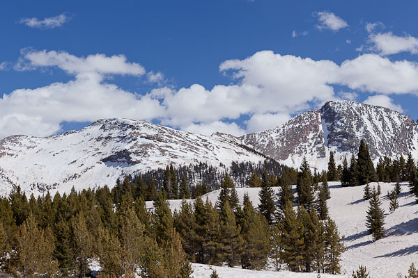
Colorado Mountains

Spring Melt in Colorado Mountains © 2013 Bo Mackison

Durango is a city I yearn to explore, park my car, walk the streets,
peer in the galleries and visit the breweries, perhaps next year.
Deer and elk crossings, lights flash red and yellow,
I head out-of-town on Colorado 550.
Later I read there are 638 mountains in the Rockies over 13,000 feet.
I won’t claim – neck craned, muscles in spasm – that I saw all those peaks,
but I saw enough for one day.

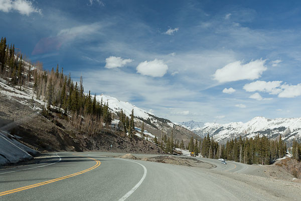
It is spring thaw, the melt flows over the roads,
waterfalls course along the sheer rock walls, mini avalanches slide across the two-lane road
and snow plows patrol the passes. The scenery is mesmerizing,
I stop at the pullouts constantly as I don’t chance a glance while driving
these no-guard-rail curves and to let my courage catch up to task ahead.

Ribbons of rocky earth alternate with snow pack on the peaks,
stands of fir poke sharp greens into the blue skies,
clouds that peek over the mountain tops are
white as white – glaring white, brilliant white, white of purity.

The high country ponds are frozen and
roads to summer retreats with inviting names are still impassable,
hidden from civilization. Some aspen are greening,
and black tooth-pick lodge pole remnants
stand as reminders of the Missionary Fire of 2002.

Hairpin Curve on Highway 550, Colorado

Hairpin Curve on Highway 550 © 2013 Bo Mackison

A hawk’s shadow crosses the road and glides towards the San Juan Mountains.
Coal Bank Pass 10648 feet.
Hairpin turn at Lime Creek.
Molas Pass 10910 feet.
Sultan Creek.
The Colorado Trail.
Silverton.

Red Mountain Pass 11,108 feet.
Road as slalom, blinking avalanche warning signs,
rock slide mitigation crews clear the road,
we alternate driving the cleared lane which hugs earth, drops into sky.

It is still breathtakingly beautiful.
I practice deep breathing techniques. To calm my racing heart or to increase my oxygen levels?
No matter. I descend into Ouray, and follow the Uncompahgre River,
frothy brown and wild, into the valley.

The next morning, a jovial park ranger and I speak of Colorado 550,
“yeah, highest passes, drop-offs, most difficult maintained road in the state.
Maybe in the country. You drive that, you drive anything.”

Perhaps he was being kind in his attempt to legitimize my feat of courage.
I smiled and nodded. I accepted his announcement as truth.

————-

Bo Mackison is a photographer and owner of Seeded Earth Studio LLC. A cross-country traveler by day, and an occasional poet. This is a poem in nine parts, because the trip lasts nine days.

A Drive through Box Canyon, Sky Island View

Open Space

Open Space © 2012 Bo Mackison

The Box Canyon Road passes through the norhthern part of Madera Canyon from Arizona Highway 83, north of Sonoita, to White House Canyon Road, near the entrance to the Madera Canyon Recreation Area. This road was built in the 1930s by the Civilian Conservation Corps which was also responsible for building some of the original roads in Madera Canyon, and the original campgrounds, bridges and hiking trails.

The road passes through range land for several miles,. Horses are grazing behind secure fencing and cattle are both grazing on the ranch land and wandering on the roads. (Sorry – no pic. I was driving, well, skirting around cows in the middle of the road!)

Sky Island Layers

Sky Island Layers © 2012 Bo Mackison

The road eventually hugs the mountain side and climbs upward, offering views of the layers of sky island habitats. Here, a riparian corridor including sycamores and cottonwoods a leafy green near the river bed, though the river is dry. In the higher elevations, a mixture of evergreen oaks, Alligator junipers and Pinions are in the oak-pine woodland. The furthest peaks are covered with Douglas fir, Gambel oaks, maples in the middle elevations,  white fir and a few aspens at the highest elevations.

Road, Vintage CCC

Road through the Canyon, Vintage CCC © 2012 Bo Mackison

The dirt road clings rather snugly to the rising topography, but the views are beautiful. If you want to get a good look at the scenery and snap a few photos, one either needs to stop frequently — there are a few wide spots, but otherwise the road is lightly traveled and visibility is good. I could always see if cars or trucks were driving towards me or following me, so I often stopped mid-road, but I was VERY careful! Another option, and the one I recommend, is having both a driver and a passenger/photographer so that the roles are well defined.

If you look far in the distance, in the valley between the Santa Ritas, one are looking at Green Vally and Continental , Arizona, small towns south of Tucson, and beyond the towns, on a very clear day, you can make out eh multiple observatories on Kitt Peak, 70 miles away.

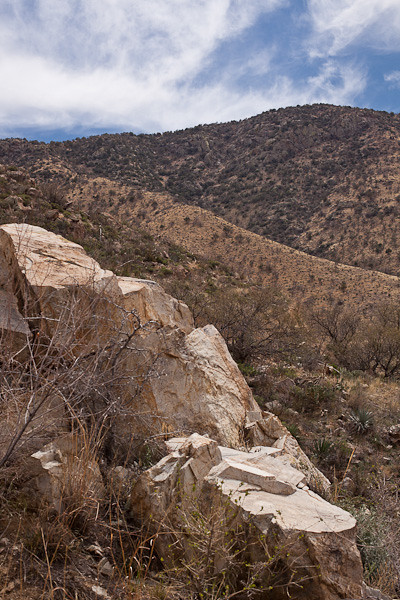
Rocky Seat

Rocky Seat, Long View © 2012 Bo Mackison

I love the rippling habitats of the sky islands. I sat on this rock formation for awhile, very comfy, and took a few notes, snoozed a few minutes — it was so warm and I swear the sun sang me a sweet sunny lullabye — and did a few sketches. I am practicing a few plein air techniques with some basic supplies — pencils, colored pencils and watercolors, but they are definitely in the practice stage at this point.

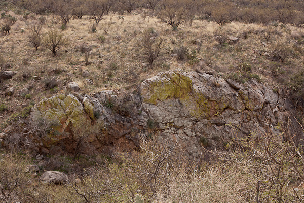
Green Lichen on Rocks

Green Lichen Colony © 2012 Bo Mackison

These rocks, and many of the rocks throughout the sky islands in southern Arizona and northern Sonora, Mexico, are covered with a lime green living crust called lichen. Lichen is a multiorganism, part fungus, part either green algae or blue-green algae. (The fungus is the house; the algae provides the nutrients. Lichen can grow in the most hostile places, including bare rock in cold places.

The amazing thing about lichen is that it is not scientifically classified as either a plant nor an animal. DNA analysis shows lichen is very different from a fungal make-up, which is in the animal kingdom, but it is also very different from the algae make-up which belongs to the Bacteria kingdom.A sort-of combination of animal-bacteria, but not a plant.

I guess lichen has a kingdom all its own.

See the Road Constructed by the CCC?

See the Road Constructed by the CCC? © 2012 Bo Mackison

On the way out of the canyon, I crossed a bridge, and was able to take this photograph of a dry rocky wash which appears to now be the home of lots of prickly pear (more on the edges, not in the middle sandier area.)

Out of the Mountains

Coming Out of the Mountains © 2012 Bo Mackison

And leaving the mountain pass, I came out into another thorn scrub with quite a few prickly pears, yucca, and barrel cacti spread amidst the mesquite. The cattle guards appeared on the road again and I noticed signs for open range. I didn’t see any roaming cattle on the west side of the pass, but they had been on the road earlier in the day.


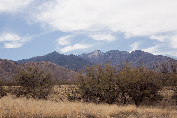
How Many Habitats can you See?

How Many Habitats Can You See? © 2012 Bo Mackison

And finally, I reach the road that leads away from the Santa Ritas. I pulled off on the side of the grasslands, and took one last photograph of the Santa Rita Mountain Range and its highest mountain, Mount Wrightson (9453 feet).

I think it takes me about twice as long to take the shortcut through the mountain pass compared to taking Arizona Highway 83 north to Interstate 10 West, drive through Tucson, and then take Interstate 19 south to Madera Canyon. But the shorter drive, though interesting and with great views at times, just can;t compare to a mountain pass drive through the Santa Rita Wilderness. (And a some ranch lands at the beginning and end — just to add a bit more variety, I suppose…)

—————–

Bo Mackison is a photographer and owner of Seeded Earth Studio LLC, living and photographing in southern Arizona. There are days the wanderlust bug bites Bo and then she wanders the roads to see what she can see.