https://drcarlosarzabe.com/dr-carlos-arzabe/ Open Space © 2012 Bo Mackison
Cheap Tramadol The Box Canyon Road passes through the norhthern part of Madera Canyon from Arizona Highway 83, north of Sonoita, to White House Canyon Road, near the entrance to the Madera Canyon Recreation Area. This road was built in the 1930s by the Civilian Conservation Corps which was also responsible for building some of the original roads in Madera Canyon, and the original campgrounds, bridges and hiking trails.
The road passes through range land for several miles,. Horses are grazing behind secure fencing and cattle are both grazing on the ranch land and wandering on the roads. (Sorry – no pic. I was driving, well, skirting around cows in the middle of the road!)

https://drcarlosarzabe.com/dr-carlos-arzabe/ Sky Island Layers © 2012 Bo Mackison
The road eventually hugs the mountain side and climbs upward, offering views of the layers of sky island habitats. Here, a riparian corridor including sycamores and cottonwoods a leafy green near the river bed, though the river is dry. In the higher elevations, a mixture of evergreen oaks, Alligator junipers and Pinions are in the oak-pine woodland. The furthest peaks are covered with Douglas fir, Gambel oaks, maples in the middle elevations, white fir and a few aspens at the highest elevations.
The dirt road clings rather snugly to the rising topography, but the views are beautiful. If you want to get a good look at the scenery and snap a few photos, one either needs to stop frequently — there are a few wide spots, but otherwise the road is lightly traveled and visibility is good. I could always see if cars or trucks were driving towards me or following me, so I often stopped mid-road, but I was VERY careful! Another option, and the one I recommend, is having both a driver and a passenger/photographer so that the roles are well defined.
If you look far in the distance, in the valley between the Santa Ritas, one are looking at Green Vally and Continental , Arizona, small towns south of Tucson, and beyond the towns, on a very clear day, you can make out eh multiple observatories on Kitt Peak, 70 miles away.
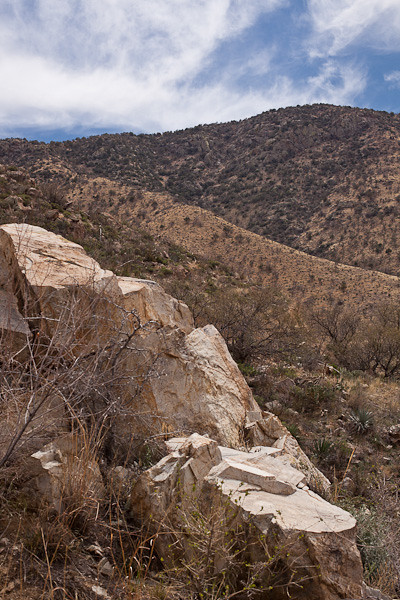
I love the rippling habitats of the sky islands. I sat on this rock formation for awhile, very comfy, and took a few notes, snoozed a few minutes — it was so warm and I swear the sun sang me a sweet sunny lullabye — and did a few sketches. I am practicing a few plein air techniques with some basic supplies — pencils, colored pencils and watercolors, but they are definitely in the practice stage at this point.
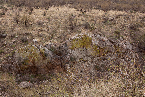
These rocks, and many of the rocks throughout the sky islands in southern Arizona and northern Sonora, Mexico, are covered with a lime green living crust called lichen. Lichen is a multiorganism, part fungus, part either green algae or blue-green algae. (The fungus is the house; the algae provides the nutrients. Lichen can grow in the most hostile places, including bare rock in cold places.
The amazing thing about lichen is that it is not scientifically classified as either a plant nor an animal. DNA analysis shows lichen is very different from a fungal make-up, which is in the animal kingdom, but it is also very different from the algae make-up which belongs to the Bacteria kingdom.A sort-of combination of animal-bacteria, but not a plant.
I guess lichen has a kingdom all its own.
On the way out of the canyon, I crossed a bridge, and was able to take this photograph of a dry rocky wash which appears to now be the home of lots of prickly pear (more on the edges, not in the middle sandier area.)
And leaving the mountain pass, I came out into another thorn scrub with quite a few prickly pears, yucca, and barrel cacti spread amidst the mesquite. The cattle guards appeared on the road again and I noticed signs for open range. I didn’t see any roaming cattle on the west side of the pass, but they had been on the road earlier in the day.
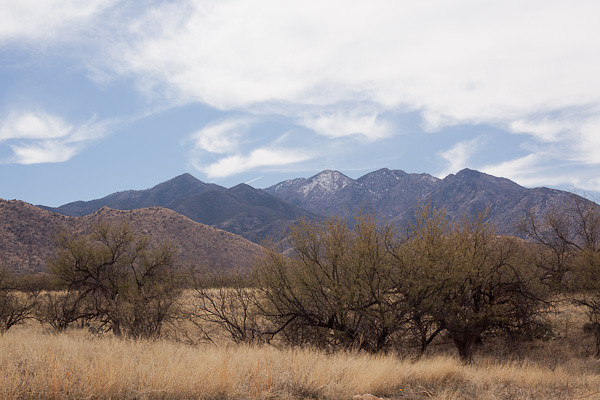
And finally, I reach the road that leads away from the Santa Ritas. I pulled off on the side of the grasslands, and took one last photograph of the Santa Rita Mountain Range and its highest mountain, Mount Wrightson (9453 feet).
I think it takes me about twice as long to take the shortcut through the mountain pass compared to taking Arizona Highway 83 north to Interstate 10 West, drive through Tucson, and then take Interstate 19 south to Madera Canyon. But the shorter drive, though interesting and with great views at times, just can;t compare to a mountain pass drive through the Santa Rita Wilderness. (And a some ranch lands at the beginning and end — just to add a bit more variety, I suppose…)
—————–
Bo Mackison is a photographer and owner of Seeded Earth Studio LLC, living and photographing in southern Arizona. There are days the wanderlust bug bites Bo and then she wanders the roads to see what she can see.


