Lookout Views from Cape Royal Road – North Rim of Grand Canyon

Grand Canyon -Kaibab Plateau

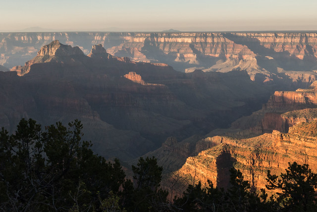
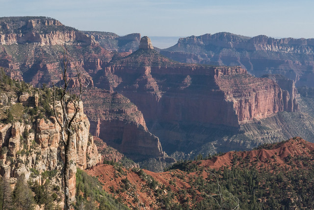
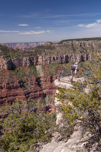
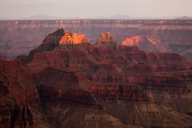
Point Imperial © 2014 Bo Mackison

We have become great because of the lavish use of our resources. But the time has come to inquire seriously what will happen when our forests are gone, when the coal, the iron, the oil, and the gas are exhausted, when the soils have still further impoverished and washed into the streams, polluting the rivers, denuding the fields and obstructing navigation. ~ Theodore Roosevelt (1906)

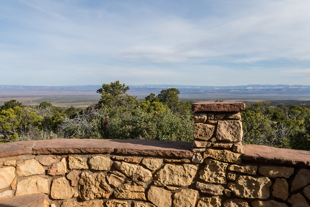
Point Imperial, 8803 feet in elevation,
Overlooking Grand Canyon to the east, and beyond, the Painted Desert.

Grand Canyon -Kaibab Plateau

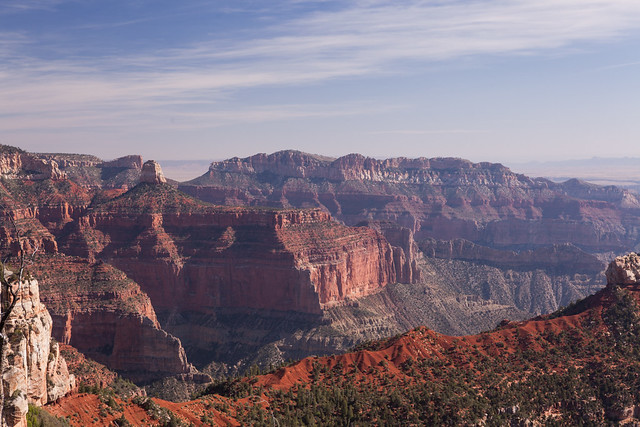
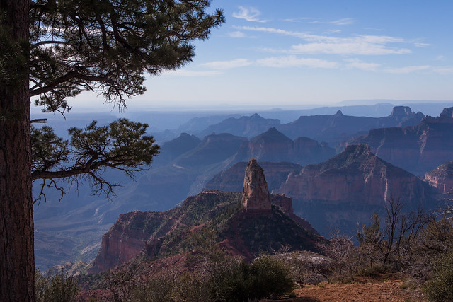
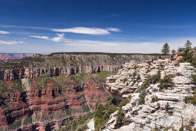
Vista Encantada © 2014 Bo Mackison

The lack of power to take joy in outdoor nature is as real a misfortune as the lack of power to take joy in books. ~ Theodore Roosevelt (1906)

Grand Canyon -Kaibab Plateau

Cape Royal © 2014 Bo Mackison

When your spirit cries for peace, come to a world of canyons deep in the old land, feel the exultation of high plateaus, the strength of moving waters, the simplicity of sand and grass, the silence of growth. ~ August Frugé

Cape Royal, the point, the southernmost view on the North Rim,
the widest panorama of any Grand Canyon overlook
the gorge has a view of about 270° of the horizon.

Look to Marble Canyon in the north, gaze south towards the Palisades of the Desert.

Grand Canyon -Kaibab Plateau

Angel’s Window from Walhalla Point © 2014 Bo Mackison

How the striking of the great clock, whose hours are millions of years, reverberates out of the abyss of the past!
~ John Burroughs

Grand Canyon -Kaibab Plateau

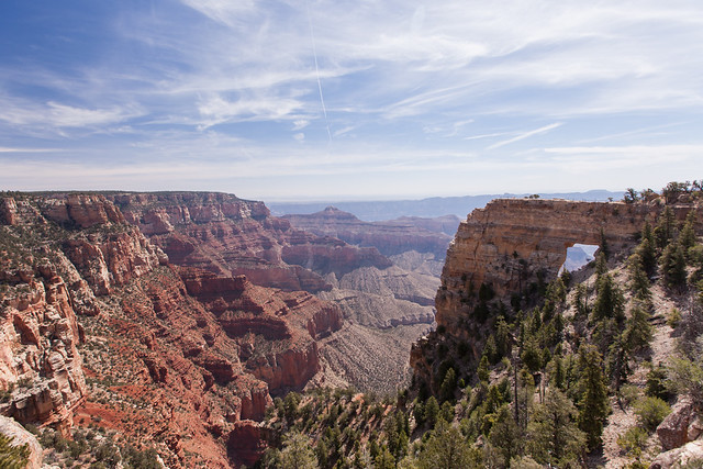
Angel’s Window, North Rim of Grand Canyon © 2014 Bo Mackison

. . . each man sees himself in the Grand Canyon – each one makes his own Canyon before he comes, each one brings and carries away his own Canyon. ~ Carl Sandburg

Grand Canyon -Kaibab Plateau

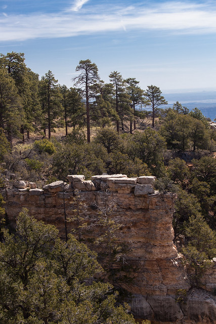
Grand Canyon Rock Formations © 2014 Bo Mackison

We are prone to speak of the resources of this country as inexhaustible; this is not so. ~ Theodore Roosevelt (1906)
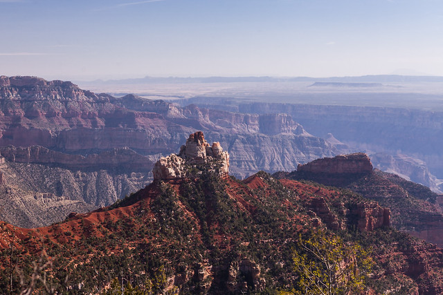
Early Morning at North Rim of Grand Canyon National Park

Grand Canyon National Park - North Rim in the Morning

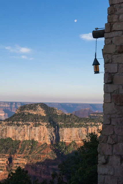
North Rim, Early Morning on the Veranda ©2014 Bo Mackison

I didn’t get to the North Rim for sunrise. 5:20 am. But I was there, coffee and camera in hand, a bit after 6.
Early enough to share the veranda with only a few early risers.
And catch a few shadows as morning was waking.

Grand Canyon National Park - North Rim in the Morning

Early Morning at Grand Canyon National Park North Rim ©2014 Bo Mackison

A view of the Norht Rim, shooting west,
and capturing the Grand Canyon Lodge.
Rock and copper and just a touch of timber.
(After fire destroyed the first lodge, a wood structure,
the second edition relied primarily on stone.)

Grand Canyon National Park - North Rim in the Morning

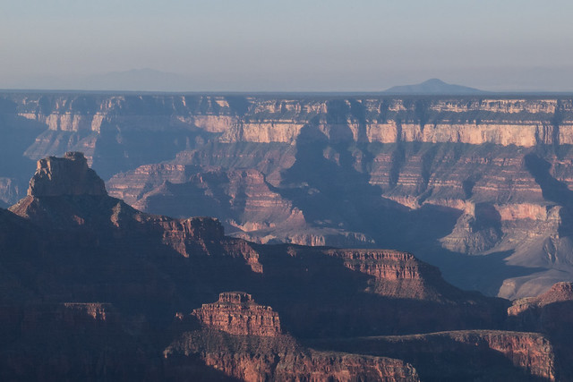
Grand Canyon National Park – North Rim in the Morning © 2014 Bo Mackison

More sunlight, more shadows and definition.
Mid day, and the canyon will be pale in comparison
to the early morning or late evening color.
Still, it was hazy. The San Fransisco Peaks, 60 miles away near Flagstaff,
I could easily see the day before, this morning they were barely visible.

Grand Canyon National Park - North Rim in the Morning

Point Imperial Overlook © 2014 Bo Mackison

Two fellow travelers and I drove to Imperial Point, and stopped along the way.
They had hiked rim to rim the day before, and wanted to see the North Rim.
No shuttle is available, so we explored together, all of us with cameras in hand.

Grand Canyon National Park - North Rim in the Morning

Morning Blues Panorama and Point Imperial © 2014 Bo Mackison

What a grand opportunity for vistas!
More photos to follow. Wouldn’t I love to
explore this bit of heaven for an entire summer.

First Day Exploring Grand Canyon National Park – North Rim

Overlook - Kaibab National Forest

Leave Kanab Utah. 6:42 am Utah time, 5:42 am Arizona time.
Partly cloudy, dulls the red rock, but sun rays streak and shimmer in the early morning.
Coffee at Jakie Leigh’s Bakery.

Street plaque commemorates the movie filming of Apple Dumpling Gang and Don Knotts.
Color Mountain Motel
Purple Sage Inn

Kanab Airport
Flagman. Traffic stops.
Time to study the layers of rock – red, yellow, white, with forest lines interspersed between the colors.

Arizona State Line.
Fredonia Arizona
Buckskin Tavern State Line Bar
Welcome to Arizona Strip District Public Lands

Moose Next 12 Miles.
Entering Kaibab National Forest
Fire Danger Moderate.

Why did the coyote cross the road?

Kaibab Lookout. Built by the Civilian Conservation Corps, 1938

Kaibab National Forest

Jacobs Lake 9 Miles
Flagstaff 173 Miles
Open range next 10 miles.

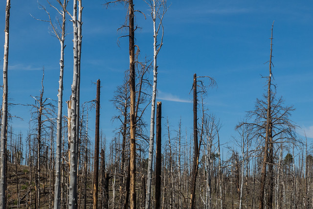
Stands of naked lodgepole pines, forest fire remnants from 2008.
Please Do Not Litter.

Junction 67. Jacobs Lake.
Jacobs Lake Inn. Elevation 7925.
cafe – motel – curios – store

Kaibab Plateau Visitor Center.
“In Memory of Theodore Roosevelt. “Teddy.” Protector of Arizona.”
Grand Canyon 45 Miles

Deer next 30 miles.
Cattle next 30 miles.
Don’t Drink and Drive.

Why did the chipmunk cross the road?
Black and white stripes on tree toothpicks, old fire damage.
Elevation 8400 feet.

Meadow, Birches just leafing.
Crane Lake, surrounded by a fence to keep the cattle out and allow the wildlife access.
Kaibab Lodge. No Vacancy.
DeMotte Campground. No Vacancy.

Grand Canyon 4 miles.
I keep reminding myself to breathe!

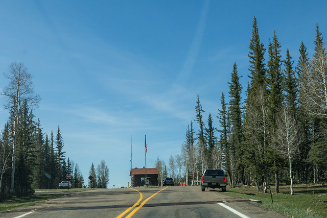
Grand Canyon - North Rim Entrance Station

I am here.
Grand Canyon North Rim Entrance.
Elevation 8250.

Icy road next 11 miles.
Only a few piles of snow, deep in the cover of the forest.
Wriggly aspen trunks – snow pressure during growth.

Grand Canyon - North Rim

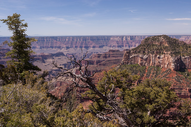
And the North Rim opens to view.
I am standing at the edge of the canyon.

Grand Canyon - North Rim

Lookout over the rim.
To take in this view would require a lifetime.
Grateful that I have even these two days.

Grand Canyon - North Rim

Rocks, rocks, and rocks.
A geologist’s haven.
And heaven, too.

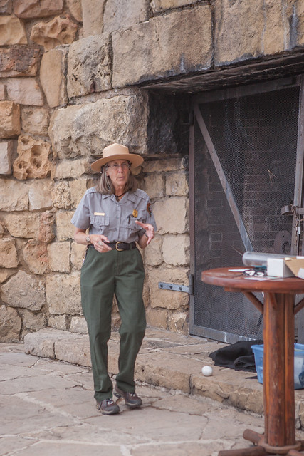
Condor Talk, Park Ranger, North Rim Grand Canyon

Condor ranger talk.
Park Ranger Gaelyn Olmstead demonstrates the proper way to build a condor nest.
Cliff edge or shallow cave. Scratch. Scratch. Done.

Grand Canyon - North Rim

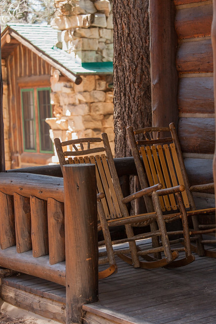
These rockers are put to good use.
Hiking is hard work. And glorious.
But at some point the feet say, “No more. Sit down.”

Temple, North Rim of Grand Canyon, at Sunset

Sunset on the veranda.
Friends from the sometimes amazing social media introduce me to Gaelyn.
Nature lovers, photographers, wanderers.

We choose to sit and chat, watching the Grand Canyon.
Another reason that Grand Canyon is so grand – the people.

Sunset approaches, the canyon does its light show,
shadow, light, red, purple, yellow.
Sunlight on the Temple.

Grand Canyon - North Rim Sunset

And the after sunset glow.
Grand Canyon – North Rim.
Views of infinite grandeur – the canyon, the sky.


Graffiti, Dam, and Dinosaurs — All in a Day’s Travel

Colorado River, Glen Canyon Dam Overlook

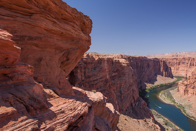
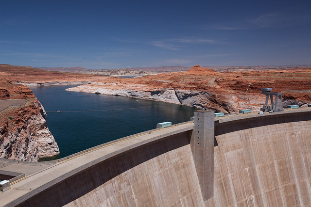
Colorado River, Glen Canyon Dam Overlook © 2014 Bo Mackison

Day two of bonus travel.  Page, Arizona.
I take a detour on a scenic view road,
discover the Glen Canyon Dam Overlook.

Glen Canyon Dam Overlook

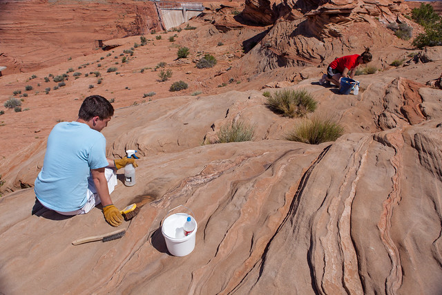
Logan and Sam, Volunteers Removing Graffiti  © 2014 Bo Mackison

On my climb down the red rock trail,
I meet three college kids hard at work,
scrub brushes in hand, cleaning graffiti from the red rock.

They tell me their story while they work.
They’re honor students from Southern Utah University
visiting Glen Canyon – hiking, exploring, and volunteering.

Glen Canyon Dam Overlook

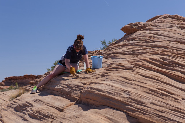
Sammi and Graffiti Removal at Glen Canyon © 2014 Bo Mackison

Logan from St. George, Sammi from Tontopah, Nevada
and Sam from Salt Lake City, all intent on cleaning the hot rock.
Logan laughs as he says, “We’re the nerdy kids, not the cool kids.”

I disagree. I think they’re the cool kids.

Glen Canyon Dam Overlook

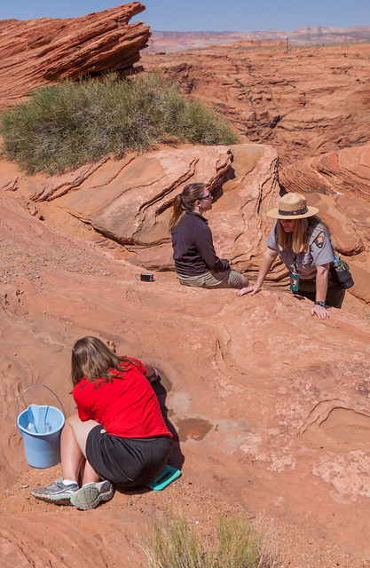
Jayci and Alyssa with Park Ranger Cynthia © 2014 Bo Mackison

Hiking on the red rock towards the Colorado River,
I meet more volunteers removing streaks of
unsightly graffiti from the red rock.

Glen Canyon Dam Overlook

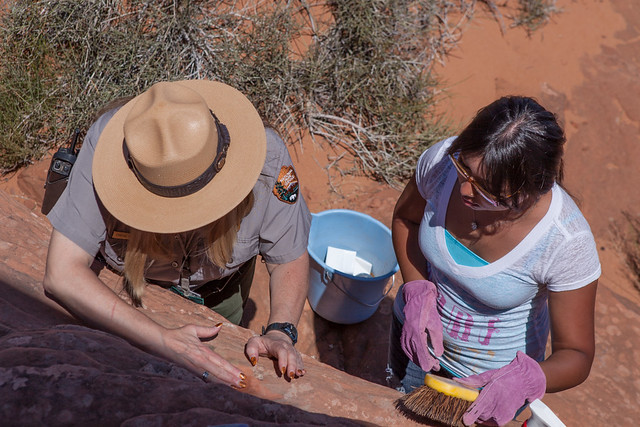
Ranger Cynthia Sequanna Demonstrating Graffiti Removal to Damaris

Jayci from Cedar City, Alyssa from St. George,
and Damaris from Salt lake City work with Park Ranger Cynthia Sequanna.
A big thanks to these students. And to the Park Ranger, too.

I’ve discovered positive energy on these red rocks, for sure.

Revived, I get back on the road,
Kanab Utah 73 miles.
Carl Hayden Visitor Center 1 mile.

Glen Canyon Dam at Carl Hayden Visitor Center

Glen Canyon Dam © 2014 Bo Mackison

Elevation 3827 feet.
Waters of the Colorado River are backed up 185 miles
by the Glen Canyon Dam to create Lake Powell.

During prolonged droughts, released water
provides for the desert cities to the south.
Full in 1980, now the lake fluctuates near the 50% mark.

I leave Arizona, enter Utah.
Its motto – “Life Elevated.”
The rock is layered in more colors than I can imagine.

Not only reds and oranges, there’s shades of gray,
white, green, blue, yellow.
Hard to drive, there’s too much to see!

BLM Dinosaur Visitor Center

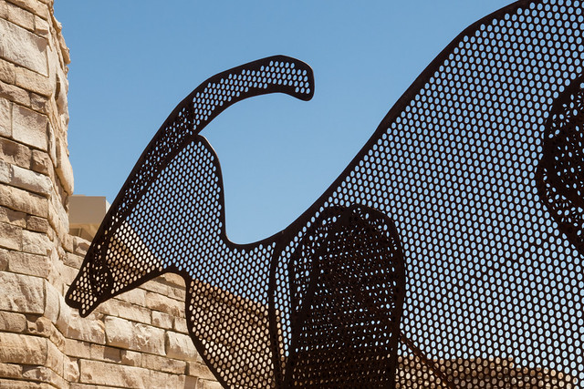
Big Water Dinosaur ©2014 Bo Mackison

Big Water, Utah.
Rocks like chimneys, puffy clouds like smoke.

Big Water Visitor Center. Grand Staircase/Escalante National Monument.
Tiny building in the big desert, but inside are huge dinosaur specimens,
bone not plastic,  from digs in the immediate area.

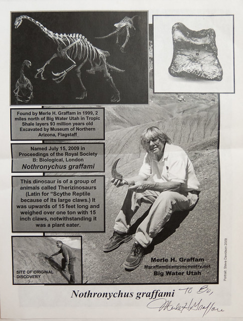
Merle Graffam and His Dinosaur Find

Flyer about Dinosaur Discover Merle Graffam © 2014 Bo Mackison

Adding another  bonus to my bonus travel,
I have the pleasure of meeting local paleontology expert Merle Graffam.

Discoverer of the first Therizinosaurus found in the Western Hemisphere,
an entirely new dinosaur species, now scientifically known as Nothronychus Graffami.

All because he decided he needed more exercise
and thought the Utah sands would be an ideal  outdoor gym.
And that claw he saw sticking out of the gray sand – yes indeed,
Graffam’s very own dinosaur.

His autograph is on the flyer, it even says “to Bo”
but Bo was so stunned by a celebrity sighting
she forgot she had her camera slung over her shoulder!

Traveling Cross Country, Learning Unexpected Lessons – Day 1

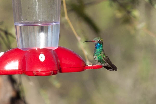
Broad billed Hummingbird, male

Broad billed Hummingbird © 2014 Bo Mackison

Sunday morning. 10:56 am
49,738 on the odometer.
The car, packed like a 3D puzzle, hums sweetly,
its mechanical issues of the past two weeks fixed,
it’s been pronounced “good as new”.

I say my farewells, a flute song, I believe the hummingbird
sipping its nectar and the green arroyo are appreciative.

The flute is my Arizona gift to myself. It is my good morning, my good night,
and now my goodbye ritual.  Blessings for the upcoming travels,
and farewell…for now. It is an imperfect song, as it should be.

I whisper “traveling mercies, Bo”
and smile at my motto for this year’s trip:
“Bo, WHOA” for Whole-Hearted, Open-Minded Adventure.

As I back away from the casita
a red-tailed hawk circles above, dips then soars to the north.

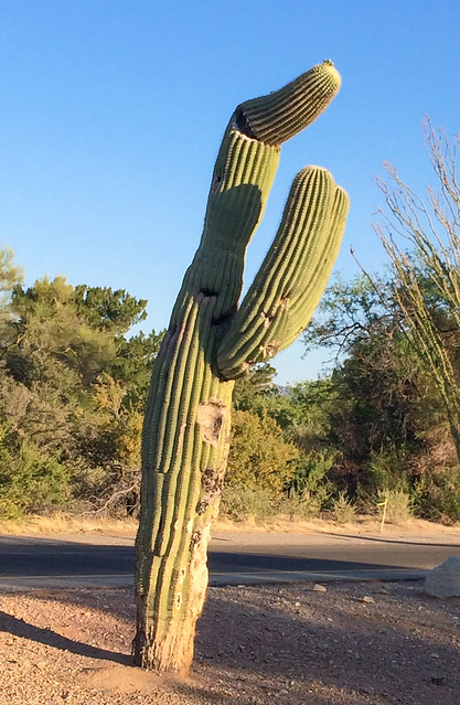
Homer, the Bald Saguaro, with Buds on his Head

Homer, the Bald Saguaro, with Buds on his Head © 2014 Bo Mackison

Homer, the cactus I’ve nicknamed and wave to every day, has nubbies on his once bald head.
flowers that will bloom long after I am gone.
Quails scuttle across the road; their babies half run, half flutter-fly.

I begin my journey. I’ll cross many bridges searching for flowing waters,
leaving one desert but always, always
entering another.

Soap tree yucca send white spikes of creamy flowers into the air.
The ocotillo, a steady bloomer since January, are nearly spent,
a single bright red cluster lingers on a branch
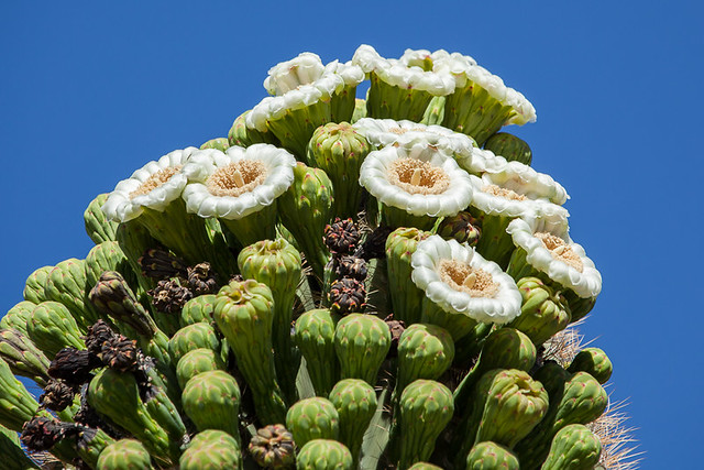
and the saguaros are thick with white saucer blossoms.

Desert Diamond Casino
Santa Cruz River, and beyond a hill like a porcupine, toothpick cacti on its back.
San Xavier del Bac Mission, the White Dove.
Desert Museum. Old Tucson. Exit Here.

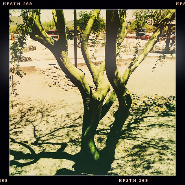
Palo Verde - Green Stick

Palo Verde – Green Stick © 2014 Bo Mackison

The desert is green in May.
Palo verde trees — green stick trees – thick and blooming yellow only last week,
dotting the desert with yellow flares,
now the blossoms lie under the trees, like a drift of yellow snow.

Flashing overhead sign:
Caution High Winds. Blowing Dust.
The sign is correct, the blue sky turns brown, all but obliterates the outlines of the mountains surrounding Tucson.

Gas is 3.31 at the circle K on Miracle Mile.
Blinking lights, road construction.
Three lanes of traffic merge into one.

Prince Street. Rillito Creek
Orange Grove Road.
Mega Wash at the RV Dealer

Tucson to Phoenix, dusty and desert scrub.
Semis sway, cross the yellow lines.
Picacho Peak is a ghost silhouette in a dusty shroud.

Cars double park in the lot at the Rooster Cogburn Ostrich Ranch.
It appears the ostriches are a popular Mother’s Day destination.

Saguaro, these ancient many-armed, appear where moments ago,
there were only fields of dust.
Tumbleweed dances across four lanes of traffic. A yellow sedan
swerves onto the narrow shoulder, slides off the road.

Gas Line Road. Maricopa County. The city encroaches.
Snarls of cars, layers of curving merges, speeding cars switching lanes.
Through Phoenix and beyond, relieved to leave metro traffic.

And then rural replaces urban.
New River, dry pebbles and dust.
Elevation 2000. Table Mesa.

What a joy to see the cacti forests abloom
like green tapers with white flames.

Top of a Saguaro Cactus in May

Top of a Saguaro Cactus in May © 2014 Bo Mackison

Little Squaw River, dusty and dry.
Rock Springs. Black Canyon City.
Yavapai County. Bumble Bee and Crown King exit – No Services.

Turn Off A/C Next 5 Miles.Avoid Overheating.
Horsethief Basin.
Fresh Oil Ahead. Reduce Speed.

Every shade of green sings life in the mountains of the high desert.
Elevation 3000 feet.

On top of the Colorado Plateau the land opens,
the skies fill with zillions of clouds.
Agua Fria National Monument.

Boulders scatter the land, scenery of the Flintstones’ Bedrock City
(and a two days’ drive to Rock Vegas)
Cordes Lake Road

Arcosanti Road. Agua Fria River – dry and rocky
The odometer turns 50,000 as I enter Prescott National Forest.

Ash Creek – dry and dusty. Elevation 4000 feet
Sacaton grasses dotted with juniper and cedar.
Cienega Creek – dry. Entering Verde Valley

General Crook Trail.Verde River – dry and dusty
Entering Cocochino National Forest. A hawk soars.
Wild Horse Mesa. Dry Beaver Creek – dry and rocky.

Sedona 17 miles.

Sedona

Sage brush balls gather in bunches, caught on the guard rail.
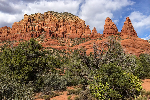
Oak Creek Canyon. The red rock rises.
I stop at Tlaquepaque to buy a pea pod necklace,
the pea a tiny pearl. A gift of love for my daughter.

The motel is within sight when the dashboard lights begin their frantic flashing.
Another repeat performance from the last two weeks.
Grateful my lodging is near, fretful of a possible travel interruption.
I stop for the night and consider the challenges of desert and wilderness.

Tomorrow will be soon enough to call a tow truck.