A Sonoran Desert Gift – Saguaro Cactus in Bloom

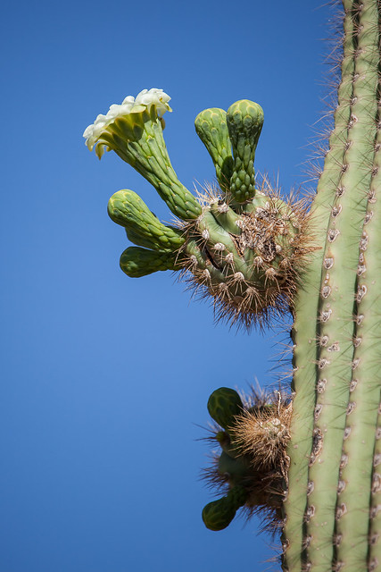
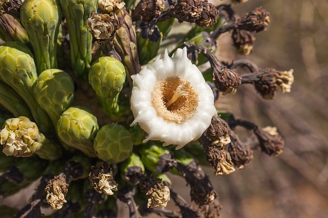
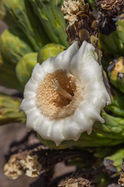
Sagauro Flower - Like A Wax Specimen

Saguaro Flower – Like A Wax Specimen ©2014 Bo Mackison

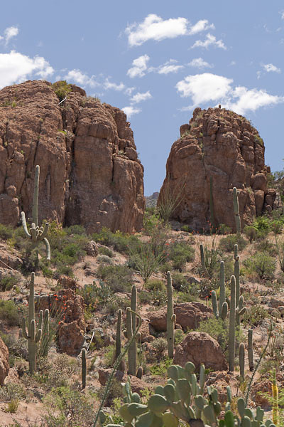
A saguaro forest is awe-inspiring any time of the year.

But it is even more spectacular during May and June when many saguaros are topped with highly decorative, three-inch wide yellow-centered, white blossoms.

Four Saguaro Flowers

Four Saguaro Flowers ©2014 Bo Mackison

The flowers open at night.

They are highly fragrant, like overripe fruit, and attract the lesser long-nosed bat, a nocturnal creature and its most prolific pollinator. Flowers stay in full bloom throughout the next morning, then they quickly shrivel into a crispy brown shell.

Many saguaro, especially the older ones, have hundreds of flowers. Only a few flowers bloom in a single day, yet the saguaro flowering season lasts eight to ten weeks.

Saguaro Cactus in Bloom

Saguaro Blossom like a Trumpet ©2014 Bo Mackison

Bats are ideal pollinators.

Since the flowers are positioned high in the air, they are easily accessible to the swooping bats plus the blossoms are extremely durable – they look like they are dipped in wax! – and are able to withstand the bat’s weight.

The flowers produce some nectar after sunrise, and so also attract bees and doves during the day, but to a lesser degree.

Untitled

Macro Saguaro ©2014 Bo Mackison

A few flowers bloom at eye level, especially on cacti whose arms are drooping towards the ground.

It takes some persistent searching – and luck – to find a blossom that can be photographed up close and personal. Most of the flowers are high atop the cacti, twenty to forty feet in the air!
Saguaro Flower

Life Cycle of Saguaro Blossoms ©2014 Bo Mackison

The blossoms that are pollinated develop into deep red, fleshy fruits in late June.

Not only do the fruits feed the bird and animal populations of the desert, they are also a traditional food of the Tohono O’odham. These people once harvested the fruits using long poles fashioned from cactus ribs. The tradition still persists, though on a limited basis.
Travel Journal – Retrospective

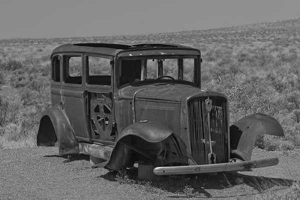
Car on Historic Route 66

Old Car © 2013 Bo Mackison

“Travel is more than the seeing of sights; it is a change that goes on, deep and permanent, in the ideas of living.”
~ Miriam Beard

I am getting ready.

In preparing for my cross-country excursion, I reread the blog posts I wrote last year when I embarked on a similar trip. I was struck by the number of elaborate memories that were evoked by reading the scant details of my nine-day road trip. It was like finding a single puzzle piece which exposed new meanings, new connections.
These brief rememberings again reminded me of the value of even the briefest of routine entries in a journal or diary.
I combined the nine days of poetry entries into one post. It’s a bit long, but it does cover nine days of traveling over 2,500 miles

Road Trip – 2,588 Miles

The First Day – Heading Cross-Country

It is sunny and 71˚ and 8:03 a.m. when I lock the door,
jam my last bag in the car.
No need to memorize the blue of the sky, it is already mine.

A red tail hawk dips into the arroyo,
I catch his wide sweep as I turn north.
Prickly pears and yucca bloom extravagantly,
Spent blossoms of the ocotillo litter the curbside.

In three hours I detour twice,
following Arizona Scenic Highway signs
like dropped bread crumbs in a dark forest.

Curve along the edges of copper mines,
layered open pits, and miners in yellow hard hats
maneuver front-loaders along the narrow ledges.

Boyce Thompson Arboretum State Park

Boyce Thompson Arboretum © 2013 Bo Mackison

I walk the paths of the arboretum at noon,
detour through Miami’s mission district at three,
at four I descend into the Salt River Canyon.

A hawk soars high above the road, I follow its shadow along the asphalt road.
Red Tails are my trip totem.
Road cuts expose the white rock of the White Mountains,
vines and creeping flowers fill the rough crevices.

5:02 p.m. I stop for the night in Show Low.
The motel is on Deuce of Clubs Street, the main drag.
Can’t show lower than the deuce of clubs, so says town legend.

Mountain Ranch

Red Earth, Blue Skies © 2013 Bo Mackison

The Second Day – Driving North in Arizona

Gas at Safeway is 3.42 a gallon,
two fishermen lean against their truck, boat in tow,
arguing about late starts and wasting time.
The older guy takes a long drag on his cigarette while he pumps gas.

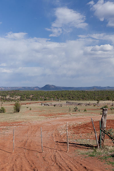
North of Show Low the topography is Illinois flat,
the soil Utah red. The heat Arizona summer.

Dead River.
Querino Wash.
Four Mile Draw, Five Mile Draw, Six Mile Draw.
Godawful flat and dusty,
telephone poles are distraction.

Past Holbrook, outcroppings jut like layers of floor sheeting.
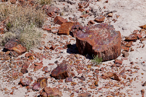
It’s a land of rock, many-layered fossil cake in rainbow hues.

Entrance signs greet and command:
“Welcome to Petrified Forest National Park.
Do Not Remove Rocks Under Penalty of Law.”
I take only photographs.

Scattered Petrified Wood

Scattered Petrified Wood © 2013 Bo Mackison

On the day I travel from mountains to plains,
I cross the state line, and whisper
“Goodbye, Arizona; Hello, New Mexico.”

I keep my place on the map by the washes I cross.
Querino Wash, dusty and dry,
Carr Lake Wash, dusty and dry.

Meandering water gives the Little Colorado River’s name veracity.
Rivers run dry in the Southwest
and imagination supplies the water.

I turn north, follow the Trail of the Ancients, Navajo Nation,
Cinder block homes and sweat lodges. Horses stand in the shade of ramadas.
Winds blow fierce, flying dust crosses the road.

I steer my car by the tracks of the pick-up truck ahead
and rocks rise from nothingness into mysterious swirling dust silhouettes.

Near Shiprock, New Mexico, a rock clipper ship rises from the plateau.
as a wailing dog circles its still companion, rigid on the roadside,
and nudges the matted, dark stained head.

I think of Sunday School Bible verse contests.
“For you were made from dust, and to dust you shall return.”
Truer than I once believed, now an astronomer’s explanation.
“You are star-dust, the heart of the star.”

Towards evening I reach Four Corners, geographical name place.
Arizona, New Mexico, Utah, Colorado touch with 90˚ precision,
Accuracy drawn by politicians and mapmakers.

I drive past the concrete historical marker
and neon-lit gift shops. There are wonders ahead.

Mesa Verde National Park - Visitor Center

Love the Stripes at Mesa Verde Visitor Center © 2013 Bo Mackison

The Third Day – A Colorado Day

37˚ at 5:40 am, I unpack the trunk to find my sweatshirt.
Truckers start their engines and let them idle over breakfast,
the couple in the next room search for their car keys.

Bickering, raised voices, gas fumes. I grab coffee
and a couple of hard-boiled eggs from the breakfast bar
and pull onto the highway as the sun rises.

Mesa Verde National Park is only minutes east. The new visitor center
receives last-minute grooming for Memorial Day’s Grand Opening.

I glance at bright exhibits on prehistoric dwellings and pottery,
but my attention’s captured by dizzying stripes of light and shadow,
building, bricks, benches, steps.
Each stripe marks time, passage on a sunlit day.

I follow the self-guided tour of Spruce House,
an Ancestral Pueblo dwelling abandoned in A.D. 1300.
And imagine life on a rock cliff with toddlers and elders.
Then I order salad and iced tea from the Spruce Tree Cafe and I am more thankful than usual.

I wander through the gift shop, the museum, explore the ancient diorama,
reluctant to leave Mesa Verde — Green Table. I depart later than planned.

Colorado Mountains

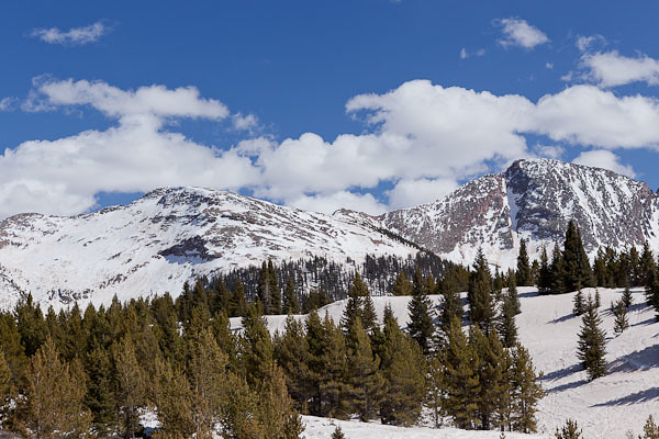
Spring Melt in Colorado Mountains © 2013 Bo Mackison

Durango is a city I want to explore, walk the streets,
take in the art in the galleries, visit the breweries. Perhaps next year?
The deer and elk crossing flashes red and yellow lights.

I head out-of-town on Colorado 550.
Later I read there are 638 mountains in the Rockies over 10,000 feet.
I can’t claim – my neck craned, muscles in spasm – that I saw them all,
but I saw enough for one day.

It is spring thaw, the melt flows over the roads,
waterfalls course along the sheer rock walls, mini avalanches slide across the two lanes
and snow patrols clear the passes. The scenery is mesmerizing.

I stop at the pullouts constantly; I don’t chance a glance while driving.
No-guard-rail curves, it’s enough to hold onto the courage I can muster.

Ribbons of rocky earth alternate with snow pack on the peaks,
stands of fir poke sharp greens into the blue skies,
clouds that peek over the mountain tops are
white as white – glaring white, brilliant white. White white.

The high country ponds are frozen and
roads to summer retreats with inviting names are still impassable,
hidden from civilization. Some aspen are greening,
and black tooth-pick lodge pole remnants
stand as reminders of the Missionary Fire of 2002.

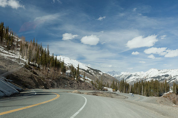
Hairpin Curve on Highway 550, Colorado

Hairpin Curve on Highway 550 © 2013 Bo Mackison

A hawk’s shadow crosses the road and glides towards the San Juan Mountains.
Coal Bank Pass 10648 feet.
Hairpin turn at Lime Creek.

Molas Pass 10910 feet.
Sultan Creek.
The Colorado Trail.
Silverton.

Red Mountain Pass 11,108 feet.
Road as slalom, blinking signs warn of an avalanche ahead
as rock slide mitigation crews clear the road.
Cars alternately drive the cleared lane which hugs earth, then drops into sky.

It is still breathtakingly beautiful.
I practice deep breathing. To calm my racing heart or to increase my oxygen levels?
No matter. I descend into Ouray, and follow the Uncompahgre River
frothy brown and wild, into the valley.

The next morning, a jovial park ranger and I speak of Colorado 550,
“yeah, highest passes, drop-offs, most dangerous maintained road in the state.
Maybe in the country. You drive that, you’n drive anything.”

Perhaps he was being kind in his attempt to legitimize my remembered fears.
I smiled and nodded. I accepted his announcement as truth.

Black Canyon National Park

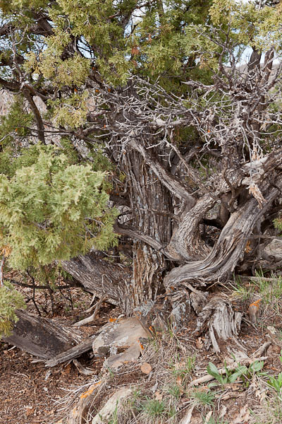
Juniper High Above Black Canyon © 2013 Bo Mackison

The Fourth Day – Colorado is a Wide State

A half-dozen times I’ve circled Black Canyon National Park on vacation maps
and a half-dozen times we lingered too long at Arches or Canyonlands,
and Black Canyon was a scratch. Who even knows there is such a place as
Black Canyon of the Gunnison National Park anyway?

Now that you can count me among its visitors, I’ll keep its secret.
Here are steep cliffs, ancient rock, craggy spires,
and walls streaked with dragon outlines, erosion’s art work
on rocky canvas 2000 feet from flowing river to cliff edge.

Black Canyon National Park

Black Canyon National Park © 2013 Bo Mackison

Oh, the quiet places, open spaces, vertical wilderness
shared with soaring hawks and eagles.
Cloud cover keeps the canyon in shadow, but the river’s song
sounds on the high mesa and wildflowers bloom
in the roots of twisted junipers.

Twenty years getting here and I have only half a day
to see what I have missed, a half day to know I must return.
When the wind gusts spike to 50 mph, I know it’s time to head east.
A tail wind helps, pushing me half-way across Colorado.

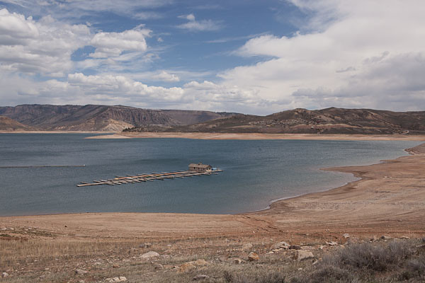
Stranded Boat Dock - Curecanti NRA

Stranded Boat Dock © 2013 Bo Mackison

Colorado has fine scenery, but those low gray clouds packed with snowy potential
overwhelm my yearn to pull over and explore.

Still, there is plenty to see –
the up and down rhythm of mountain, valley, mountain.
Tumbleweeds skirt the highways.

Cimarron, Colorado. Conjurer of Wild West sagas.
Lakes half filled, driftwood sculptures lace the sandy edges.
And colors bleached by winter’s touch take on color —
greening grasses, tree twigs in muted yellows, pinks, rusty reds,
Weeping willows in yellow-green tangles.

Calves snooze in muddy pastures,
content as their mothers graze nearby.

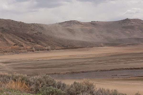
Dust Storm at Curecanti NRA

Dust Storm at Curecanti © 2013 Bo Mackison

Dust clouds swirl around my car at Curecanti.
I stop again at a ranger station.
It’s a slow day for recreation, the staff ply me with coffee, maps,
highlight the safest route through the eastern mountain passes.
Another hawk sweeps past my car; hawks are this trip’s companion bird.

San Isabel National Forest.
Steepy Mountain.
Monarch Pass. Fitting, Monarch is the pass to bid me farewell
as I cross the Continental Divide and head towards the plains.

Salida and a stop at Sally’s Cafe for coffee.
The road follows the Arkansas River,
running with spring melt, thunder-crashing into protruding red rock.
Fly fishermen queue for prime locations.

In the high desert town of Cañon City
I watch the last hawk of the day —
dancing, sky diving, welcoming the soft evening.


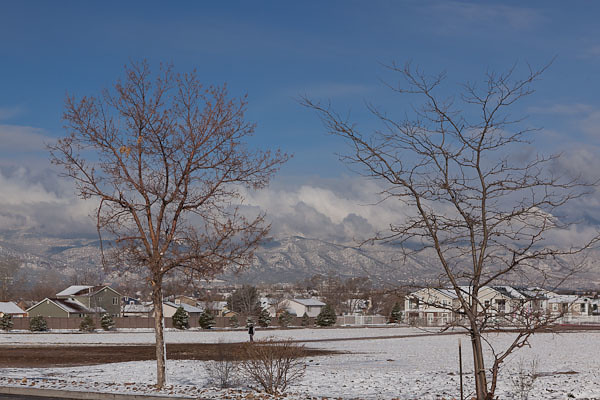
May First Snow in Colorado Springs

May First Snow in Colorado Springs © 2013 Bo Mackison

The Fifth Day – A Day of Wait

A perfect excuse for a sabbatical from car claustrophobia is a freak May storm.
It chased me across Colorado and caught up with me in Colorado Springs.

Content with a quiet room, lap pool, and breakfast bar,
I plan an all day writing/photography retreat – revival for a weary traveler.

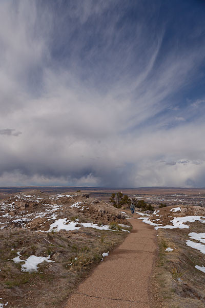
Atop Scottsbluff National Monument

Nebraska Panhandle © 2013 Bo Mackison

The Sixth Day – Trekking to Nebraska’s Panhandle

May 2nd and I head northwest as city rolls into country.
Cars at awkward angles jut from ditches, victims of yesterday’s icy sleet.
Yellow road sign: No plowing. 7 pm to 5 am.

I delight in beds of deep purple wildflowers on the roadsides.
Sheep, cows, horses share small pastures.
A trickling creek winds around thick-rooted bare branched tree relics.

Snyder, Colorado.
1st Street, 2nd Street, 3rd Street, 4th Street.
Asphalt roads in the villages; county roads are dirt ruts.

Circuitous, the South Platte runs wild with snow melt,
and snow still clumps around fence poles, in the tree thickets.

Scottsbluff National Monument

Scotts Bluff National Monument ©2013 Bo Mackison

Clouds are familiarly scattered; every second grader draws this sky.
Looking for coffee, I stop at the Prairie Cafe in Stoneham.
Abandoned. A penciled sign — “closed, be back soon” — dangles from a cracked window.

I cross into Pawnee National Grassland though grasses are rare in these parts.
Instead these Grasslands are home to tanks and army helicopters,
I pull over for a camo-caravan led by a blaring-siren police unit.

Army games and cattle farms dominate my road view of National Grasslands.
With relief I leave Pawnee and cross the Colorado/Nebraska border.

Scotts Bluff National Monument

Path into the Storm © 2013 Bo Mackison

My day’s destination – Scotts Bluff National Monument.
Scotts Bluff, sandstone rising 800 feet above the North Platte,
once an eagerly sought landmark by travelers on the Oregon, Mormon and California trails.

An eagerly sought landmark by this traveler, too.
I walk a rare mixed-grass prairie, listen to Ranger Lucy’s stories of history,
experience her passion for the land, I’m thankful I have time enough to explore.

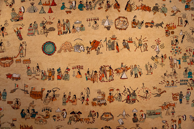
Pictograh by Native American Artist, Agate Fossil Beds National Monument Visitor Center

Pictograph by Native American Artist © 2013 Bo Mackison

The Seventh Day – Nebraska Panhandle to Black Hills

Scottsbluff, Nebraska. 7:10 a.m. 34˚F. Sunny. Windy.

Smoke hangs in the air as I head north out of town.
Cook Oil Road.
Gas Engine Road.
Narrow valleys shrouded with heavy fog.

Wild turkeys on the roadside look prime for a Butterball feast,
No kin to the elongated, scrawny fowl of Wisconsin.
Black calves peer though the wire fencing,
one has a pure white face. Who knew a cow can be this beautiful?

Agate Fossil Beds National Monument on the Nioroba River.
The ranger unlocks the Visitor Center, it’s early on a Friday.

He story tells his way through the exhibits, proud of
the people in the murals,  their discoveries and kind deeds.
A calendar pictograph covers the wall – a peoples’ history.

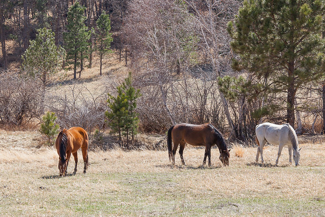
Horses in Custer State Park

Horses in Custer State Park © 2013 Bo Mackison

Trees appear in the distance as I drive
battered road in Ogallala National Grasslands.
Antelope stare, then break into an elegant run.

Ardmore, Nebraska, I’m nearly through town before I realize it’s a ghost town.
Old houses and churches, broken windows in faded businesses, out of business signs.
Old cars, but no people, no voices. No signs of life, of living.

Driving turns hypnotic, I jerk alert when I see a curve sign.
Enveloped by soft greens, soft mounds, soft sounds, I continue –
My car, the narrow asphalt road, and me.

Historical Sign Ahead: Wood Stage Memorial Marker.
Cheyenne River, a narrow ribbon of brown.
Wild Horse Refuge. and the hills turn Crayola crayon green.

Cascade Falls, Black Hills National Forest.
Bison chili at the Blue Bison Cafe in Hot Springs.

Buffalo Right of Way

Buffalo Right of Way © 2013 Bo Mackison

Wind Cave National Park,
I skip the cave tour and watch the buffalo instead.

Often I wait, my foot on the brake, as the buffalo ignore me.
Huge beasts, shaggy and disheveled, shedding their winter coats.

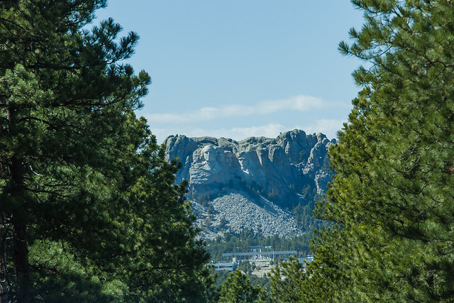
Mount Rushmore from Afar

Mount Rushmore from Afar © 2013 Bo Mackison

I detour through Custer State Park, relive memories of a family summer vacation
twenty years past; there was a pop up camper,
a hotel-preferring husband, three kids and me, all on our first big explore of the West.
Memory making moments, still favorite childhood memories.

I pull out my camera when Mount Rushmore, framed in a narrow tunnel, takes me by surprise.

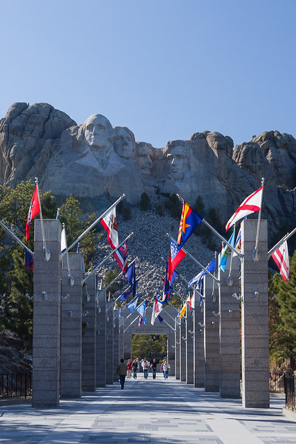
Flags at Mount Rushmore

Flags at Mount Rushmore © 2013 Bo Mackison

Miles down the road, I hesitate.
Stop at Mount Rushmore National Monument? I’ve already seen it…

Once more memories crowd my thoughts, I stop, pay the exorbitant parking fee,
and walk to the empty benches in front of the four Presidents.

That same vacation long ago…
my 9-year-old son sat beside me for half a day, spellbound.
Craning his neck, staring, studying,
stunned into silence by the thought of a mountain, a sculptor and a chisel.

That memory was worth the stop.

Badlands National Park

Entering the Badlands © 2013 Bo Mackison

The Eighth Day – Badlands, and Then the Interstate

Rapid City. 6:27 am. Sunny and 37˚F.
Filling the car’s gas tank is the first priority – $2.94 a gallon,
cheapest gas on my travels. I buy sunglasses when I go in to pay for my gas.

Standard equipment in Arizona, I’ve three missing pairs in the car,
and I’m driving due east into sunrise.
Streaks of garish orange flames decorate the cheapest pair that fit.
No matter. I buy them in a hurry to find the back road to the Badlands.

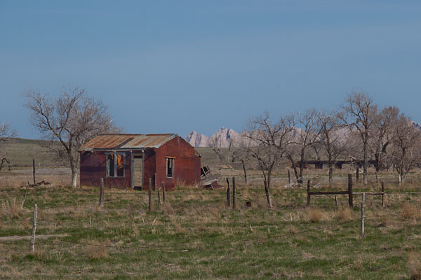
I’m the sole traveler on Highway 44 for miles, the country’s rough, desolate, beautiful.
The Badlands rise from prairie, stark layers of sediment,
rock ribbons in tan, gray, yellow, black.

Grasslands and badlands – a contrasting combination
of pale green growth and rock erosion. Soul soothing.

Badlands National Park

Badlands National Park © 2013 Bo Mackison

My hike is brief – an hour in, an hour out – I take the time.
Hiking in rocky wilderness is good for what ails me.

I celebrate with lunch, Indian Tacos at the Cedar Pass Cafe,
visit the Badlands National Park’s Visitor Center.
Roam through the twenty site campground – more family trips
come to mind. I am grateful I’ve held tight to these decades-old memories.

For 2100 miles, I’ve avoided the mindless Interstate roads, but no longer,
Back roads that head east aren’t an option.
Roads in South Dakota head to outlying ranches or farms, or towns 50 miles to the south.

I pull on I-90 East, set the cruise control, and become traffic.
Destination: Sioux Falls, dinner, the last night in a hotel room.

On this last night, I wade through puddles in the cold rain
walking to the nearest restaurant, and splurge on a steak.
It comes with a salad bar – a twenty foot long table,
bowls mounded with fresh veggies, potato salads, Jello, fruit cocktail.

Tomorrow I will be in Wisconsin, but for now,
green Jello and a walk in the rain soak me in Midwestern welcome.

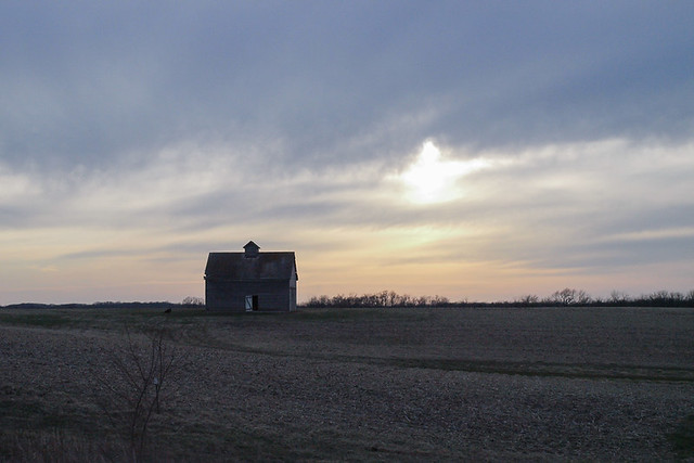
Iowa Farms

Abandoned Barn © 2013 Bo Mackison

The Ninth Day – And Home

Sioux Falls, South Dakota. 7:17 am. 41˚ and a cold drizzle.
I study the map with deep intention.
450 miles from my destination, and suddenly I yearn to be home. Now.

Damp, gray clouds spread before me, hugging close to the ground.
It’s farther than I want to drive, but never mind.
I phone home, “No stops today. I’ll be there by 3.”

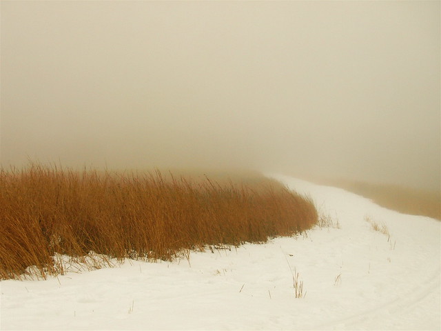
Fog thickens, once spinning windmills disappear into mist,
only the brown-black soil drenched with slick puddles is visible.

For distraction’s sake, I turn on the radio, listen to an interview in progress,
Maya Angelou recalls her youth, and words of wisdom she lives by,
I catch bits and pieces as I concentrate on steering
around wide load trucks and semi trucks, double strung.

“Love liberates love,” she says. “Doesn’t bind.”
I think of my four-month stay in Arizona.
Angelou speaks of her mother’s words: “I’d love to have you near me,
but if that isn’t possible – go.” The ultimate gift.

The exit sign for Rushmore, Minnesota shifts into view,
red wing blackbirds dart from field post to billboard post.
Worthington, Minnesota.
“Love liberates love. Love doesn’t bind,” the voice of the radio informs.

I take a break from the steady rain, pull out my umbrella,
pace the pavement in front of a square of concrete rest-stop.
Winded and chilled, I wipe raindrops from my arms and face,
resume the drive.

Piano notes fill the car’s interior, Bill Evans plays Peace Piece.
My chest tightens, but the need to drive safely is stronger than my urge to weep.
It’s been a long drive, a long stay away.

A swarming flock of crows mobs a hawk.
Skies lighten, blue window of sky,
only a glimpse before gray returns.

Iowa Farms

Glimpse of Sun © 2013 Bo Mackison

In central Minnesota, I exit I-90. Back roads cut the angle.
State highways wind through the countryside. Snow covers fields.
Shooting Star Scenic Highway.

At the VFW east of Adonis, I wait in a traffic jam.
Drivers park cars along the road, there’s a crowd
standing outside, neatly in a long line.
Flashing neon sign — Chicken Dinner, Noon to 2.
I munch on almonds and string cheese. My apple rolls onto the floor.

LeRoy, Minnesota.
Upper Iowa River at flood stage.

More music on the radio – Unchained Melody by the Righteous Brothers,
James Taylor crooning You Are My Only One.
I’ll Make Love to You by Boyz II Men.

I’m at flood stage, too.

MN 56, US 63 South, IA 9 East.
I zag across state lines, searching for short cuts.
Lionel Richie’s Truly plays on the radio. Really? Universe, I am listening.

I pull to the roadside, take deep breaths, gulp water from a plastic bottle,
then turn off the radio to concentrate on the road.

My breathing comes easier as I cross the Mississippi at Marquette
and two hawks dive from the limestone cliffs, land on a sliver of river island.
On the eastern shore, the governor’s sign welcomes me to Wisconsin.

At Mount Ida, slowed in a 20 mile an hour zone, I study a woman
as she spray paints her yard’s dried seed heads bright iridescent blue.
I smile. Then I grin.

An hour later, I pull into my driveway. Home.


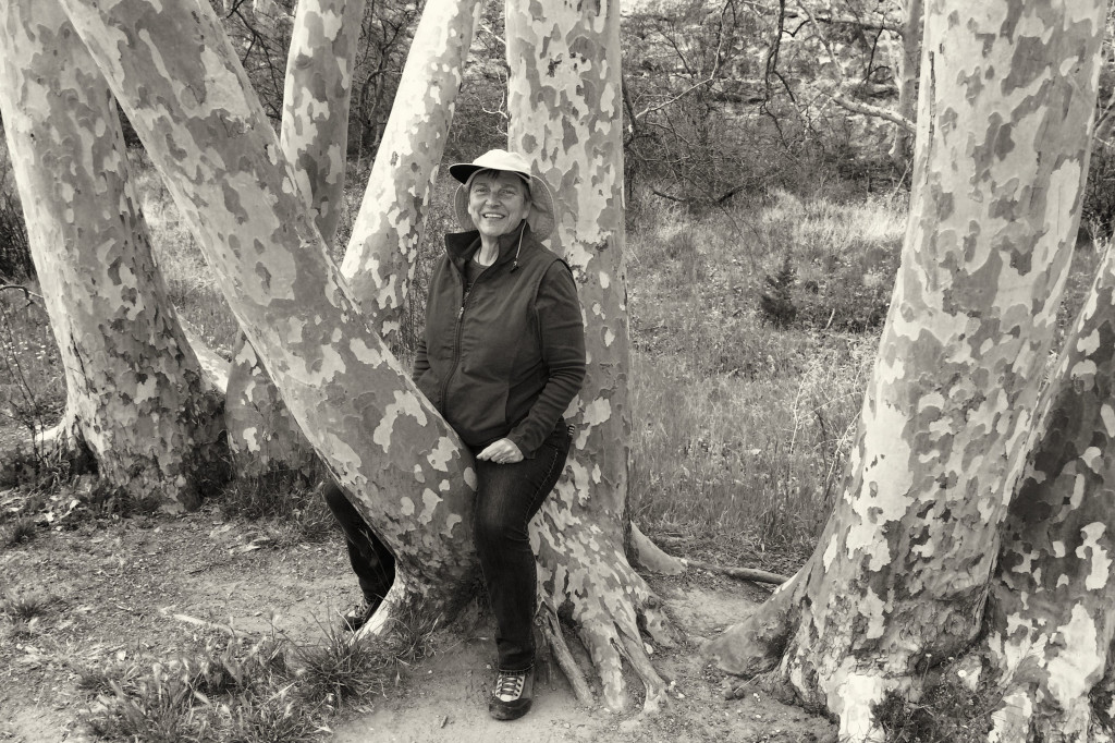
Arizona Sycamores at Montezuma Castle National Monument – The Trees and Me!

IMG_2347

Portrait with Arizona Sycamores © 2014 Bo Mackison

It’s not often that I post a photo of me. I am the one with the camera in hand and haven’t much embraced the practice of selfies. So I am seldom in a photo, and happy enough to be the one behind the camera.

But these trees — these Arizona sycamore trees were not only calling to me, they were singing my name! They were insistent. “Sit on my perfect little tree nook and smile for the camera.” And so I did.

Aren’t those trees magnificent? I can never resist running my hands along their bark, connecting the many puzzle pieces I see.

I am honored to have had my portrait taken in the midst of such grand company!

Practice Resurrection — Photographs to Wendell Berry’s Manifesto

All Text: Excerpted from “Manifesto: The Mad Farmer Liberation Front”  by Wendell Berry

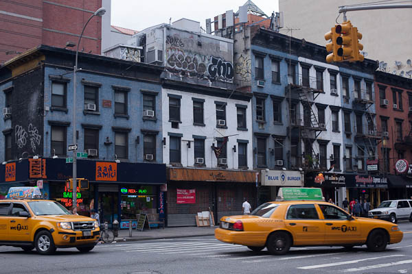
Yellow Cabs

Yellow Cabs © 2013 Bo Mackison

Love the quick profit, the annual raise,
vacation with pay. Want more
of everything ready-made. Be afraid
to know your neighbors and to die.

Pop Art Shopping Carts

Pop Art Shopping Carts © 2011 Bo Mackison

When they want you to buy something
they will call you. When they want you
to die for profit they will let you know.

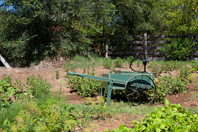
Garden Water Pump in Sanford Farm Garden, Old World Wisconsin

Farm Garden, Old World Wisconsin © 2012 Bo Mackison

So, friends, every day do something
that won’t compute. Love the Lord.
Love the world. Work for nothing.
Take all that you have and be poor.
Love someone who does not deserve it.

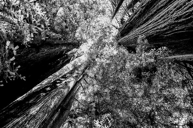
Redwood Abstract

Redwood Abstract © 2013 Bo Mackison

Ask the questions that have no answers.
Invest in the millennium. Plant sequoias.
Say that your main crop is the forest
that you did not plant,
that you will not live to harvest.

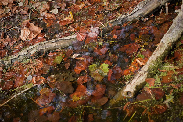
What's in this Pond?

In this Pond © 2012 Bo Mackison

Say that the leaves are harvested
when they have rotted into the mold.
Call that profit. Prophesy such returns.

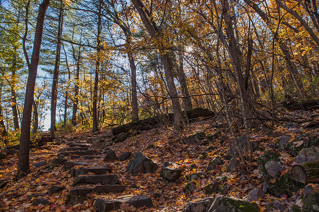
West Bluff, Devils Lake State Park

West Bluff © 2014 Bo Mackison

Put your faith in the two inches of humus
that will build under the trees
every thousand years.

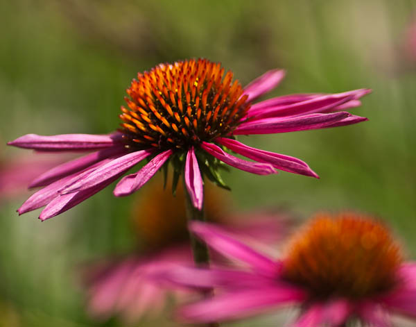
Spreading Joy

Coneflower Joy © 2013 Bo Mackison

Expect the end of the world. Laugh.
Laughter is immeasurable. Be joyful
though you have considered all the facts.

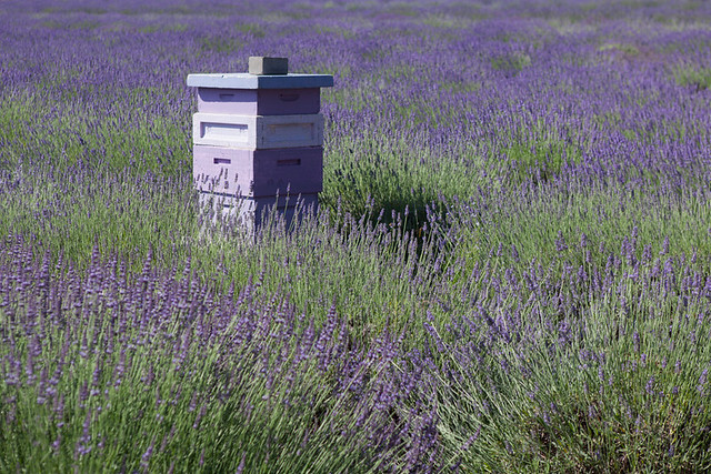
Lavender Fields and Bee Boxes

Lavender Fields and Bee Boxes © 2013 Bo Mackison

Go with your love to the fields.
Lie down in the shade. Rest your head
in her lap. Swear allegiance
to what is nighest your thoughts.

The Path Beyond

The Path Beyond © 2011 Bo Mackison

Be like the fox
who makes more tracks than necessary,
some in the wrong direction.

Kure Beach Sunrise, November 8, 2013

Kure Beach Sunrise © 2013 Bo Mackison

Practice resurrection.


Excerpts from “Manifesto: The Mad Farmer Liberation Front”  by Wendell Berry

Inspired by blog post How to Practice Resurrection and Earth Day Every Day, Through the Luminary Lens  by Bruce Thomas Witzel

A Series of Photographs – Exploring the Creative Process

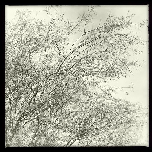
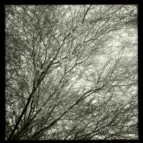
Palo Verde

Palo Verde © 2014 Bo Mackison

Lens: Jimmy
Film: Claunch 72 Monochrome

Often I am a slow photographer.

I check the times of sunrise and sunset, and plan shooting times to take advantage of the golden light. I pack my camera bag with a combination of multiple lenses and diffusers and hoods, with dust protectors and extra batteries and memory cards. I attach a heavy tripod to the bag, too.

This is slow photography. I sit and absorb the feel of a place. I connect with the space. I may wait for a certain cloud formation to float into a certain location, or a shadow to darken a rock.

And though it can be hard work, I find most of  the process passionately engaging. (I could do without the extra gear weight, especially when hiking in the desert, but…that’s part of the experience.)

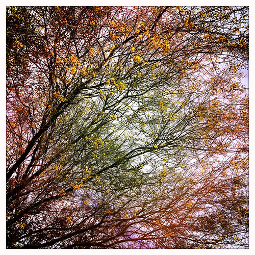
Palo Verde

Palo Verde © 2014 Bo Mackison

Lens: Jane
Film: Blanko

But sometimes I am a spur of the moment photographer.

I grab my iPhone. I open the camera and I start shooting.

One of my favorite techniques for letting go and giving myself full permission to enjoy the process is what I refer to as my “shake and take” technique.

Palo Verde

Palo Verde © 2014 Bo Mackison

Lens: Kaimal Mark II
Film: Blanko

Yep. I open the Hipstamatic app on my iPhone and I take a photo.

Then I simply shake my cell phone. The app randomly changes lenses and film and I retake the photograph. I often shake and take a dozen photos of the same subject. Then I look at the photographs.

I’ll get a few duplicates – same lens and film combination – and choose which one I prefer. Otherwise, I simply take what pops up randomly.

I find it fascinating how the different combinations change a simple subject.

Palo Verde

Palo Verde © 2014 Bo Mackison

Lens: Jane
Film: Claunch 72 Monochrome

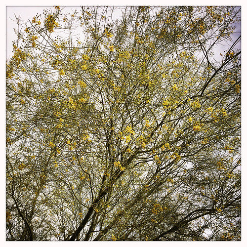
In this series, I took photos of a palo verde tree while in my car.

I was waiting for a friend and noticed the overhanging branches dangling over the car. I opened the window, aimed towards the sky, took a photo, shook the cell phone, and then repeated. A lot!

Happily, the app records the lens, film, and other data, so when I find a combination I am fond of, I can replicate it with different subjects.

Palo Verde

Palo Verde © 2014 Bo Mackison

Lens: Lucifer VI
Film: Blanko

There’s a lot to be said for a creative process that can change with my mood.

Slow and pensive, quick and experimental, metaphorical or playful. The many moods of the photographer and the resulting photos.