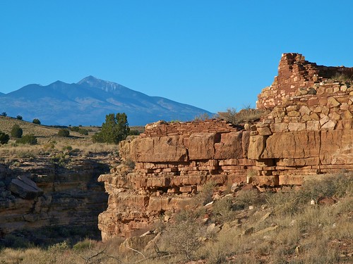
Cheap Tramadol Next Day Delivery Box Canyon Dwellings © 2008 Bo Mackison
Wupatki isn’t a what, it’s a where. It is one of the five National Monuments we visited in Arizona when we were traveling the Southwest in October.
Tramadol Mastercard Wupatki National Monument is a high desert country that is 15 miles north of Flagstaff, Arizona. The region is extremely dry and supports a few stunted juniper trees and desert creatures. It seems like a rather inhospitable place to settle and farm, but that is exactly what an early group of Native Americans did. As early as 500 AD, people we refer to as the Sinagua (“without water”) built homes and farmed small plots of land. They took advantage of water run-offs collected in a variety of pottery vessels to irrigate their corn, gathered edible plants, and hunted in the nearby mountains and desert grasslands where a larger variety of animals lived.

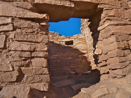
Purchase Tramadol Overnight Lomaki Pueblo – Doorway to the Bluest of Skies © 2008 Bo Mackison
https://www.circologhislandi.net/en/conferenze/Tramadol For Sale Online Uk The National Monument contains more than 2,700 ruins, the remains of structures that were inhabited until about 1400 AD. They constructed villages of multilevel, masonry pueblos. The Sinagua used red sandstone outcrops to act as a backbone for the bricks of fractured rock to make walls. To the north and west, the walls were built high to give protection against the winds; the walls to the south and east were terraced to take advantage of the winter’s sun. A water collection system was built into their flat roofs, and rain water was directed into storage pots.
These photographs are of Box Canyon dwellings, including Lomaki Pueblo, one of the smaller settlements in Wupatki. (Lomaki is the Hopi word for “beautiful house.”) Only a few of the pueblos are open for viewing. Most are protected against disturbance, but the buildings and area are not forgotten or abandoned. The Hopi and Zuni peoples believe their ancestors who lived and died here remain as their spiritual guides. They occasionally come to the grounds to enrich their personal histories and understanding of their clan.


