Traveling the Badlands and Beyond

Badlands National Park

Entering the Badlands © 2013 Bo Mackison

Rapid City. 6:27 am. Sunny and 37˚F.
Filling the car’s gas tank is morning’s first priority – $2.94 a gallon,
cheapest gas on my travels. I buy sunglasses as I pay for my gas.
Standard equipment in Arizona, I’ve three lost pairs in the car,
and I’m driving due east into sunrise.
Streaks of angry orange flames decorate the cheapest pair that fit.
No matter, I buy them, in a hurry to find the back road to the Badlands.

I am the sole traveler on Highway 44 for miles, the country’s rough, desolate, beautiful.
The Badlands rise from prairie, stark layers of sediment,
rock ribbons in tan, gray, yellow, black.
Grasslands and badlands – a contrasting combination
of pale green growth and rock erosion. Soul soothing.

Badlands National Park

Badlands National Park © 2013 Bo Mackison

My hike is brief – an hour in, an hour out – I make the time.
Hiking in rocky wilderness is good for what ails me.
I celebrate with lunch, Indian Tacos at the Cedar Pass Cafe,
visit the Badlands National Park’s Visitor Center.
Roam through the twenty site campground – more family trips
come to mind. I am grateful I’ve held tight to these decades-old memories.

I’ve avoided the mindless Interstate roads for 2100 miles, but no longer,
Back roads that head east are no longer an option.
Roads in South Dakota head to outlying ranches or farms, or towns 50 miles to the south.
I pull on I-90 East, set the cruise control, and become traffic.
Destination: Sioux Falls, a decent dinner, a quiet hotel room.

On my last night on the road, I wade through puddles in the cold rain,
enter the nearest restaurant,
and order a steak. It comes with a first class salad bar –
bowls mounded with fresh veggies along a twenty-foot table.

Contentment eases into my being.
Tomorrow I will be in Wisconsin,
but for now, a walk in the rain soaks me in Midwestern welcome.

—————

Bo Mackison is a photographer and owner of Seeded Earth Studio LLC. A cross-country traveler by day, and an occasional poet by night. This is a poem in nine parts, because the trip lasts nine days. This is Day Eight.
Pictographs, Buffalo, Mount Rushmore, Memories

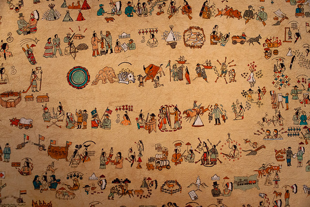
Pictograh by Native American Artist, Agate Fossil Beds National Monument Visitor Center

Pictograph by Native American Artist © 2013 Bo Mackison

Day 7 – Nebraska Panhandle to Black Hills

Scotts Bluff, Nebraska. 7:10 a.m. 34˚F. Sunny. Windy.

Smoke hangs in the air as I head north, leaving town.
Cook Oil Road.
Gas Engine Road.
Narrow valleys shrouded with heavy fog.

Wild turkeys on the roadside look ready for a butterball feast,
No kin to the elongated, scrawny fowl in Wisconsin.
Black calves peer though the wire fencing,
one has a pure white face, striking in his difference.

Agate Fossil Beds National Monument on the Nioroba River.
The ranger unlocks the Visitor Center, it’s early on a Friday,
He story tells his way through the exhibits, proud of
the people in the murals and their discoveries and kind deeds.
A calendar pictograph covers the wall – a peoples’ history. Striking.

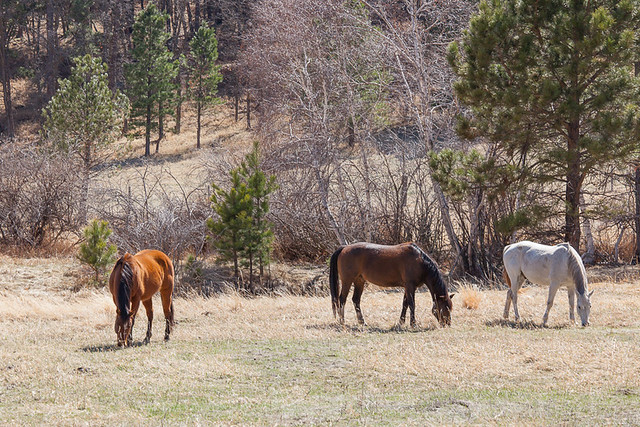
Horses in Custer State Park

Horses in Custer State Park © 2013 Bo Mackison

Trees appear in the distance as I drive
the battered road in Ogallala National Grasslands.
Antelope stare, then break into an elegant run.

Ardmore, Nebraska, nearly out-of-town before I notice it’s a ghost town.
Old houses and churches, broken windows in faded businesses, out of business signs,
old cars, but no people, no voices. No signs of movement, of living.

Driving turns hypnotic, I jerk alert when I see a curve sign.
Enveloped by soft greens, soft mounds, soft sounds, I continue –
Me, my car, the narrow asphalt road.

Historical Sign Ahead: Wood Stage Memorial Marker.
Cheyenne River, a narrow ribbon of brown.
Wild Horse Refuge. and the hills turn Crayola Crayon Green.
Cascade Falls, Black Hills National Forest.
Bison chili at the Blur Bison Cafe in Hot Springs.

Buffalo Right of Way

Buffalo Right of Way © 2013 Bo Mackison

Wind Cave National Park,
I skip the cave tour and watch the buffalo instead,
often I wait, my foot on the brake, as the buffalo ignore me.
Huge beasts, shaggy and disheveled, shedding their winter coats.

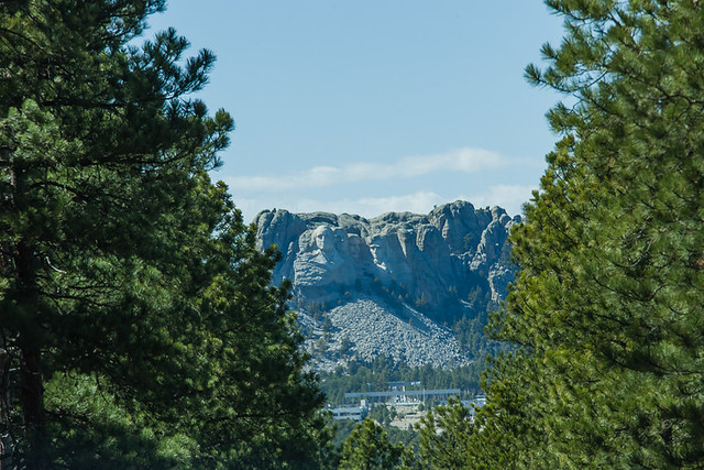
Mount Rushmore from Afar

Mount Rushmore from Afar © 2013 Bo Mackison

I detour through Custer State Park, relive memories of a family summer vacation
twenty years past; there was a pop up camper,
a hotel-preferring husband, three kids and me, all on our big explore.
Memory making moments, still precious, favorite childhood memories.

I pull out my camera when Mount Rushmore, framed in a narrow tunnel, takes me by surprise.

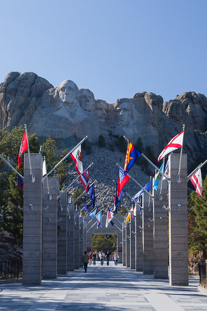
Flags at Mount Rushmore

Flags at Mount Rushmore © 2013 Bo Mackison

Miles down the road, I hesitate.
Stop at Mount Rushmore National Monument? I’ve already seen it…

Once more memories crowd my thoughts, I stop, pay exorbitant parking fees,
and walk to the empty benches in front of the four Presidents.
That vacation long ago…
I remember the 9-year-old boy who sat next to me for a half day,
craning his neck, staring, studying
stunned into silence by the thought of a mountain, a sculptor and a chisel.

The memory alone was worth the stop.

______________

Bo Mackison is a photographer and owner of Seeded Earth Studio LLC. A cross-country traveler by day, and an occasional poet. This is a poem in nine parts, because the trip lasts nine days. This is Day Seven.

Nebraska Panhandle and Beyond

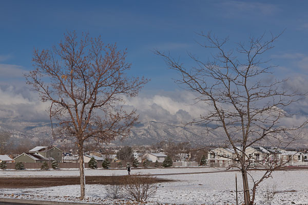
May First Snow in Colorado Springs

May First Snow in Colorado Springs © 2013 Bo Mackison

Day Six – Trekking to Nebraska’s Panhandle

A perfect excuse for a day sabbatical from the car was a freak May 1st storm
that followed me across Colorado and caught up with me in Colorado Springs.
Set with a quiet room, a lap pool, and a breakfast bar,
I planned an all day writing/photography retreat – revival for a weary traveler.

May 2nd and I head northwest, city rolls into country,
cars angled awkwardly in ditches remain from yesterday’s icy sleet.
Yellow road sign: No plowing. 7 pm to 5 am.

Atop Scottsbluff National Monument

Nebraska Panhandle © 2013 Bo Mackison

I delight in beds of deep purple wildflowers on the roadsides.
Sheep, cows, horses share small pastures.
A trickling creek winds around thick-rooted bare branched tree relics.

Snyder, Colorado.
1st Street, 2nd Street, 3rd Street, 4th Street.
Asphalt roads in the villages, county roads are dirt ruts.
Circuitous, the South Platte runs wild with snow melt,
and snow clumps around fence poles, in the tree thickets.

Scottsbluff National Monument

Scotts Bluff National Monument ©2013 Bo Mackison

Clouds are famously scattered, every second grader draws this sky.
Looking for coffee, I pause at the Prairie Cafe in Stoneham.
Abandoned, a sign — “closed, be back soon” — dangles from a cracked window.

I cross into Pawnee National Grassland, though grasses are rare in these parts.
The Grasslands are home to tanks, army helicopters,
I pull over for a camo caravan led by a siren-warning police unit.
Army games and cattle farms dominate my road view of National Grasslands.
With relief I leave Pawnee and cross the Colorado/Nebraska border.

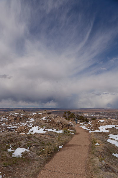
Scotts Bluff National Monument

Path into the Storm © 2013 Bo Mackison

My day’s destination – Scotts Bluff National Monument.
Scotts Bluff, sandstone rising 800 feet above the North Platte,
an eagerly sought landmark by travelers on the Oregon, Mormon and California trails.

And an eagerly sought landmark by this traveler, too.
I walk a rare mixed-grass prairie, listen to a ranger’s  historical stories,
experience her passion for the land and I have time enough to explore.

——————

Bo Mackison is a photographer and owner of Seeded Earth Studio LLC. A cross-country traveler by day, and an occasional poet. This is a poem in nine parts, because the trip lasts nine days. This is Day Five and Day Six.

Crossing Colorado

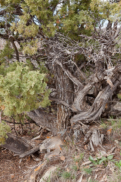
Black Canyon National Park

Juniper High Above Black Canyon © 2013 Bo Mackison

The Fourth Day – East Across Colorado

A half-dozen times I’ve circled Black Canyon National Park on vacation maps
and a half-dozen times we lingered too long at Arches or Canyonlands,
and Black Canyon was scratched. Who even knows there is such a place as
Black Canyon of the Gunnison National Park anyway?

Now you can count me among its visitors, I’ll keep its secret.
Here are steep cliffs, ancient rock, craggy spires,
and walls streaked with dragon outlines, erosion’s art work
on rocky canvas 2000 feet from flowing river to cliff edge.

Black Canyon National Park

Black Canyon National Park © 2013 Bo Mackison

Oh, the quiet places, open spaces, vertical wilderness
shared with soaring hawks and eagles.
Cloud cover kept the canyon in shadow, but the river’s song
sounded on the high mesa and wildflowers bloomed
in the roots of twisted junipers.

Twenty years getting here and I had only half a day
to see what I had missed, a half day to know I’ll return.
When the wind gusts spiked at 50 mph, I knew I’d pushed my luck,
but a tail wind pushed me half-way across Colorado.

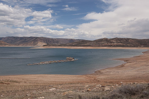
Stranded Boat Dock - Curecanti NRA

Stranded Boat Dock © 2013 Bo Mackison

Colorado has fine scenery, but those low gray clouds packed with snowy potential
overwhelmed my yearn to pull over and explore.
Still, there was plenty to see –
the up and down rhythm of mountain, valley, mountain.
Tumbleweeds skirted the highways.

Cimarron, Colorado. Conjurer of Wild West.
Lakes half filled, driftwood sculptures lace the sandy edges.
And colors bleached by winter’s touch take on color — 
greening grasses, tree twigs in muted yellows, pinks, rusty reds,
Weeping willows in yellow-green tangles.
Calves snooze in muddy pastures,
content as their mothers graze nearby.

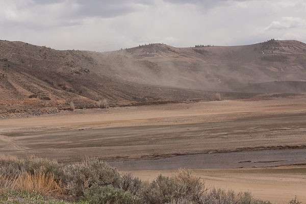
Dust Storm at Curecanti NRA

Dust Storm at Curecanti © 2013 Bo Mackison

Dust clouds swirl around my car at Curecanti.
I stop at another ranger station,
it’s a slow day for recreation, the staff ply me with coffee, maps,
highlight the safest route through the eastern mountain passes.
Another hawk sweeps past my car, hawks are my companion bird this trip.

San Isabel National Forest.
Steepy Mountain.
And then Monarch Pass. Fitting, Monarch is the pass to bid me farewell
as I cross the Continental Divide and head towards the plains.

Salida and a stop at Sally’s Cafe for coffee.
The road follows the Arkansas River,
running with spring melt, thunder-crashing into protruding red rock.
Fly fishermen queue for prime locations.

In the high desert town of Cañon City
I watch the last hawk of the day —
dancing, sky diving, it welcomes the evening.

———

Bo Mackison is a photographer and owner of Seeded Earth Studio LLC. A cross-country traveler by day, and an occasional poet. This is a poem in nine parts, because the trip lasts nine days. This is day four!

Painted Desert Inn

Painted Desert Inn

Window in Adobe © 2013 Bo Mackison

The Painted Desert Inn is within the boundaries of the Petrified Forest National Park and on the original Route 66. It is situated high on a mesa overlooking the Painted Desert.

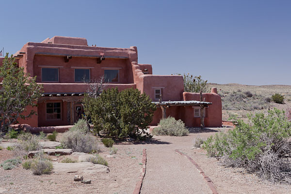
Painted Desert Inn

Painted Desert Inn © 2013 Bo Mackison

Built in the early 1920s by Herbert D. Lore, it offered lodging and dining in a remote setting on the Colorado Plateau. Purchased by the National Park Service in 1935, it underwent extensive remodeling under the supervision of architect Lyle Bennett. Men in the Civilian Conservation Corps (CCC) did much of the labor.

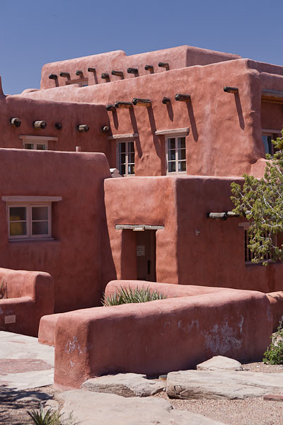
Painted Desert Inn

Painted Desert Inn © 2013 Bo Mackison

The building’s red-stucco, stone walls are more than two feet thick. Multiple layers, flat roofs with Ponderosa Pine beams, and flagstone courtyards add great character and the high desert sunlight offers contrast between light and shadow.

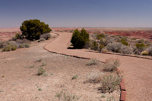
Outlook Path at Painted Desert Inn

Outlook Path at Painted Desert Inn © 2013 Bo Mackison

Imagine being a visitor to the lodge in the early 1940s. A traveler could get lodging, meals, souvenirs…and an unforgettable view of the setting sun from this overlook point at the rear of the building.

(The inn was restored in 2006 to look as it did in 1946. It is now a museum and a National Historic Landmark.)

——————

Bo Mackison is a photographer and owner of Seeded Earth Studio LLC.    As she travels cross-country, she is visiting National Parks and Monuments on her route.