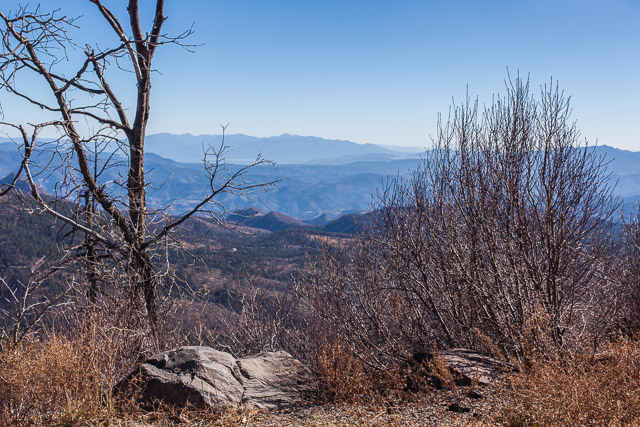
https://www.circologhislandi.net/en/conferenze/ Coronado Trail in the White Mountains ©2012 Bo Mackison
https://www.circologhislandi.net/en/conferenze/Tramadol Order Cod “A traveler without observation is a bird without wings.” ~ Moslil Eddin Saadi
Day 3. More notes from my travel log.
http://economiacircularverde.com/que-es-la-economia-circular/ We leave Albuquerque. It is 5:55 am and it’s a bit chilly – 45˚F. It is still dark, though there is the barest hint of light in the eastern sky.
We begin by traveling south on Interstate 25, but after 80 miles, we choose a scenic route on a state highway. The trip will be a few hours longer but more interesting. I have a hard time resisting a 120 mile scenic drive through mountains!
As soon as we turn off the busy interstate, I find myself breathing more deeply, my eyes become clearer and I can see further. I feel calmer driving on the less traveled roads, seeing the locals and an occasional traveler, stopping frequently to take a few photographs.
We climb in elevation as we approach the White Mountains. It is still early morning, still cool and getting colder. As we drive near the Magdalena Mountains – highest peak is South Baldy at 10,783′ – we are at 6700′ and the temperature has dropped to 23˚. Sky islands!
We keep seeing signs for “VLA” – not sure what that means. Finally we come to a high plains that has a Very Large Array of radio satellite dishes. I feel like we are traveling on the moon!
We pass Historic Hoof Highway – a trail developed in 1885. It once connected Springerville, Arizona, to Magdalena, New Mexico, a distance of 130 miles. There were supplies and a well every ten miles – a rather adventurous plan – but thousands of livestock passed those miles in good health because of the Hoof Highway.
Not only are there junipers and cedars now, there are Ponderosa pines. Telephone pole pines.
I wonder if there is a hand-held device that tells the altitude? I’m often curious about the altitude when I travel, especially when I’m hiking up and down mountain trails.
We drive across the Continental Divide.
Pie Town, New Mexico
Cross the New Mexico/Arizona border at 10:21 am.
Coyote Wash (dry)
Escadillo Mountain, the highest peak is 10,992′. First snow we have seen covers its peak.
Springerville, AZ, founded in 1870, elevation 6973′. Last chance for gas for 120 miles.
We turn south and drive 120 miles on the Coronado Trail, from Springerville to Clifton. It is a road that thinks it is a roller coaster.
Roosevelt Lake
Nutrioso Creek (water)
Cambell Blue Wash (water)
Hannagan Creek (water)
We begin in the high plains, drive for several hours through the White Mountains and finally reach the Chihuahuan Desert. From Ponderosa pine and sycamores dressed in their autumn yellow to prickly pear, barrel cacti and ocotillo in a few hours.
Eagle River (dry)
San Simon River (dry)
There are cotton fields in Safford – elevation 2920′. Some is already picked and wrapped in huge rolls, ready for truck hauling. Other fields are have dark plants half white with fluff of cotton.
We turn on I-10 — now it’s a straight shot across half the state to the Tucson area.
Stockton Wash (dry)
Adams Peak Wash (dry)
San Pedro River (dry)
Cienega Creek (dry)
We turn off the interstate at Sahuarita. It is 4:05. Sunny and warm. 80˚F.
The pecan trees in the orchards are still green, though a few of their leaves are yellowing.
In another 10 minutes we are at our destination. We walk the neighborhood, watch the sun set behind the mountain ridge, finally unpack the car.
We traveled 1963 miles over 4 days. (First leg of the trip was on the Wednesday before Thanksgiving, when we drove 300 miles straight south to celebrate with the family before leaving for the Southwest.)
It is 81˚F.
I am back home in the desert!
~~~~~~~~~~~~
Bo Mackison is a photographer and the owner of Seeded Earth Studio LLC. Happy! Home!


