Arbor on Adobe – November’s Photo-Heart Connection

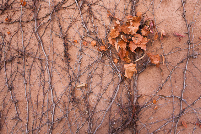
Arbor on Adobe

Arbor on Adobe ©2012 Bo Mackison

Your task is not to seek love,
but merely to seek and find
all the barriers within yourself
that you have built against it. ~ Rumi

I love walls, I especially love abode walls. And I love adobe walls that have grape vines creeping all over most of all.There is just something about the combination of a wall with abode and grape vines that makes me grab my camera and check the space on my memory card.

I had an absorbing hour – yes, hour, thank you Sherpa for your patience – taking photographs of this particular adobe wall in Old Town Albuquerque. There were parts of the wall with cracks, parts of the wall with just a bit of the vine, some parts had clusters of blue grapes, some had leaves like this photograph. Together, they combine to tell a lovely story about the wall and the grape-vine.

I chose this as November’s Photo Heart Connection partly because it seemed so fitting for a photograph taken in November – the growing season is over and the vines are leaves are curling, crackling, falling off the vine. And partly because this was Day 3 of a four-day , cross-country trip, and we especially made time to visit Albuquerque instead of zooming through the city while bemoaning the fact that we didn’t have time to stop.

This photograph reminds me that time continues, seasons change, years pass. And if I don’t make time for pauses in a hectic life, make time to enjoy the sights and sounds of life, then I miss out on experiences that make my life meaningful. It pairs well with the above quote from Rumi. I can set up barriers that prevent me from fully partaking in life and love, or I can seek and find those barriers and take them down.

————

Bo Mackison is a photographer and the owner of Seeded Earth Studio LLC.  This is her November Photo-Heart Connection contribution.
Traveling through the Mountains

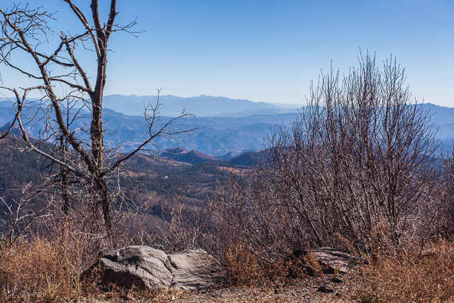
Coronado Trail in the White Mountains

Coronado Trail in the White Mountains ©2012 Bo Mackison

“A traveler without observation is a bird without wings.”  ~ Moslil Eddin Saadi      

Day 3. More notes from my travel log.

We leave Albuquerque. It is 5:55 am and it’s a bit chilly – 45˚F. It is still dark, though there is the barest hint of light in the eastern sky.

We begin by traveling south on Interstate 25, but after 80 miles, we choose a scenic route on a state highway. The trip will be a few hours longer but more interesting. I have a hard time resisting a 120 mile scenic drive through mountains!

As soon as we turn off the busy interstate, I find myself breathing more deeply, my eyes become clearer and I can see further. I feel calmer driving on the less traveled roads, seeing the locals and an occasional traveler, stopping frequently to take a few photographs.

We climb in elevation as we approach the White Mountains. It is still early morning, still cool and getting colder. As we drive near the Magdalena Mountains – highest peak is South Baldy at 10,783′ – we are at 6700′ and the temperature has dropped to 23˚. Sky islands!

We keep seeing signs for “VLA” – not sure what that means. Finally we come to a high plains that has a Very Large Array of radio satellite dishes. I feel like we are traveling on the moon!

We pass Historic Hoof Highway – a trail developed in 1885. It once connected Springerville, Arizona, to Magdalena, New Mexico, a distance of 130 miles. There were supplies and a well every ten miles – a rather adventurous plan – but thousands of livestock passed those miles in good health because of the Hoof Highway.

Not only are there junipers and cedars now, there are Ponderosa pines. Telephone pole pines.

I wonder if there is a hand-held device that tells the altitude? I’m often curious about the altitude when I travel, especially when I’m hiking up and down mountain trails.

We drive across the Continental Divide.

Pie Town, New Mexico
Cross the New Mexico/Arizona border at 10:21 am.
Coyote Wash (dry)

Escadillo Mountain, the highest peak is 10,992′. First snow we have seen covers its peak.
Springerville, AZ, founded in 1870, elevation 6973′. Last chance for gas for 120 miles.

We turn south and drive 120 miles on the Coronado Trail, from Springerville to Clifton. It is a road that thinks it is a roller coaster.

Roosevelt Lake
Nutrioso Creek (water)
Cambell Blue Wash (water)
Hannagan Creek (water)

We begin in the high plains, drive for several hours through the White Mountains and finally reach the Chihuahuan Desert. From Ponderosa pine and sycamores dressed in their autumn yellow to prickly pear, barrel cacti and ocotillo in a few hours.

Eagle River (dry)
San Simon River (dry)

There are cotton fields in Safford – elevation 2920′. Some is already picked and wrapped in huge rolls, ready for truck hauling. Other fields are have dark plants half white with fluff of cotton.

We turn on I-10 — now it’s a straight shot across half the state to the Tucson area.

Stockton Wash (dry)
Adams Peak Wash (dry)
San Pedro River (dry)
Cienega Creek (dry)

We turn off the interstate at Sahuarita. It is 4:05. Sunny and warm. 80˚F.

The pecan trees in the orchards are still green, though a few of their leaves are yellowing.

In another 10 minutes we are at our destination. We walk the neighborhood, watch the sun set behind the mountain ridge, finally unpack the car.

We traveled 1963 miles over 4 days. (First leg of the trip was on the Wednesday before Thanksgiving, when we drove 300 miles straight south to celebrate with the family before leaving for the Southwest.)

It is 81˚F.

I am back home in the desert!

~~~~~~~~~~~~

Bo Mackison is a photographer and the owner of Seeded Earth Studio LLC.  Happy! Home!

Bad Luck to Steal Saints

Bad Luck to Steal Saints

Bad Luck to Steal Saints ©2012Bo Mackison

Retabaleros. These are versions of dozens of Catholic saints painted in the classical style on Masonite. This store in Old Town Albuquerque had a large display of these little plaques, and as an added bonus offered a friendly warning– bad luck to steal — especially the saints. ~ Bo Mackison

Day 2. A short day of travel. Yay!

While we have traveled through Albuquerque, even spent the night there a couple of times, usually we are in a hurry to get to our final destination. This trip we made an extra effort to plan some visiting time in Albuquerque.

We left Tucumcari, New Mexico at 6:40 am. Our destination is the Hotel Parque Central in central Albuquerque, a renovated hospital turned hotel, and an awesome place to visit.

Mesas are most beautiful when the early morning sun casts golden highlights upon them. The beginning of what I all the high desert. No large cacti. Lots of sage brush, prickly pears.

We watch the shadow of our car travel along the side – our car on the road, the shadow of our car “driving” on the access road. Lots of laughs.

Gas is $3.39 a gallon for regular. Only once did we see the price dip under three dollars. (Always cheapest in the Kansas City area!)

Now cedars and junipers dot the desert scrub. Little balls of tight green foliage. There is more brittle bush, cholla, yucca.

This is the beginning of the land that tunes my soul, makes my heart sing. I have a heart connection with the Southwest.

Blanco Creek (dry)
Pecos River (dry)

Western Kansas, Oklahoma and Texas — to me, they all look like “the west.” New Mexico feels like “out west.” Is there a difference? I wonder?

We pass the Sangre de Cristo Mountains and the city of Albuquerque spreads out in front of us. It is 9:22 am when we pull into the hotel’s parking lot.

We play tourist much of the day. Visit Old Town Albuquerque (where I took the above photo) and wander through stores and art galleries. In the afternoon, we hike the trails at the Petroglyph National Monument on the western side of Albuquerque. We walk the bosque along the Rio Grande for some late afternoon exercise. Then have dinner with a blogging friend who has become a real life friend. How sweet is that!

—————————

Bo Mackison is a photographer and the owner of Seeded Earth Studio LLC. One more day of travel before Bo once again sees the Sonoran Desert!

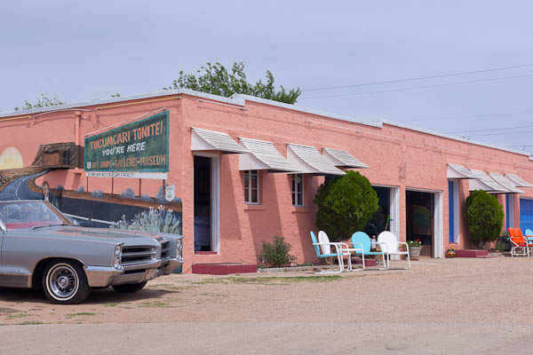
Tucumcari Tonite

Tucumcari Tonite - Historic Route 66

Tucumcari Tonite ©2012 Bo Mackison

The world is a country which nobody ever yet knew by description; one must travel through it one’s self to be acquainted with it. ~ Lord Chesterfield

Day 1 Part 2. The travel notes continue:

We note the differences between Iowa/Illinois and Missouri. Missouri has fewer corn fields. It looks scrubbier, homes are smaller. The land is undulating, like Iowa – gentle hills, lots of stands of old trees, mostly oaks.  There are more horses, fewer cattle and no dairy farms. The barns are used less for protection of animals, more for storage of grains. They are open and often have several lean-to sheds propped against their exterior walls.

Passing Hamilton MO, boyhood home of J C Penney. Hmmm.

Sunlight streams though the stand of oak, all is a rich golden brown in the low sunlight. They look like shimmering cinnamon sticks.

Cameron MO. Gas is $3.07. We finally get on an interstate to make faster time. I-35.

Passing ENCHANTED FROG ANTIQUES. Looked interesting, but not open. Wonder how it got its name?

First time we see gas for less than three dollars a gallon. $2.99 at Exit 40. Why is gas always cheapest around Kansas City area? — we notice this every time we pass through.

Head into Kansas City, MO at 8 am.

Crossing the Missouri River – managed a few photos of the overhead structure of the bridge. The HISTORIC IMPERIAL BREWERY BUILDING is for sale. It has style, bet it was a real beauty, back in its heyday.

Fishing Creek
Turkey Creek
Missouri River

Kansas state line. 34 degrees and sunny as we leave Kansas City, KS. 8:30 am.

Entering the Flint Hills of Kansas. There is a National Geographic spread — 22 pages – on the Flint Hills in its April 07 issue. So the sign says.

Bull Creek
Wolf Creek
Ottawa Creek
Marias de Cinega
Tequa Creek

Kansas compared to western Missouri? Flatter lands, still shrubby. Farms have fewer barns and store more of their equipment and larger household appliances outside. Oil wells – the ones that stand about 8 feet tall – pump in many fields.

Speed limit has gradually increased from 55 in Wisconsin to 65 in Iowa to 70 in Missouri and now it is 75 mph.

The woods are oak, hickory, sycamore. Only an occasional evergreen tree or shrub.

Rock Creek
Coal Creek
Long Creek
Frog Creek
Badger Creek

Why is Marion, KS called the Rhino Capitol of the World?

Stopped at the Tall Grass Prairie National Wildlife Refuge. There is a nearby bed and breakfast, CLOVER CLIFF RANCH. I would like to stay here for a few nights. What a great setting, looks like a great ranch!

Long trains are now frequent. Freight cars pulled and pushed by 4 to 6 engines.

Landscape is mostly grasslands. Fewer stands of trees. Most of the trees we see were planted for windbreaks around ranches and farms.

Emporia KS is the Founding City of Veterans Day. It is a good place for historic buildings, too. Historic district.

Past Emporia, the tenor of the land is drier, colorless. Many shades of brown, but the rich soil is a deep black. The landscape is offset only by a pale blue sky. Most of the land is for grazing. The buildings are built close to the ground – earth huggers – a good idea in this tornado and blizzard belt.

There is an underground salt mine in Hutchinson KS. Hutchinson is called the “Salt City.” It also has a rescue/adoption program for wild mustangs. Gas is $3.21.

Cow Creek
Ninnescah River
Arkansas River

Only scattered farms. Lots of solitude to be found in western Kansas. Still very dry.

Crooked Creek (dry)
Cimarron Creek (dry)
Pony River (dry)
Beaver River (dry)

Now we are in Oklahoma, crossing just a snippet of its Panhandle. It looks like southwestern Kansas – not a surprise. There is sage brush, dried grasses. And the feed lots – which always make me fret over my decision not to be a strict vegetarian.

Now we are in Texas. We are crossing a bit of this state’s Panhandle, too. Gas is $3.27 a gallon in Dalhart, Texas.

We arrive in Tucumcari and find a hotel, order carry-out for supper. It is 5:45 pm.

On out first travel day, designed to be long on driving while we are both fresh, we traveled 14 hours and drove 863 miles.

Tomorrow we arrive in Albuquerque early, and take time off for exploring, before the last leg of our journey.

——————

Bo Mackison is a photographer and the owner of Seeded Earth Studio LLC. She loves to document facts and trivia in her travel journals when traveling cross country.


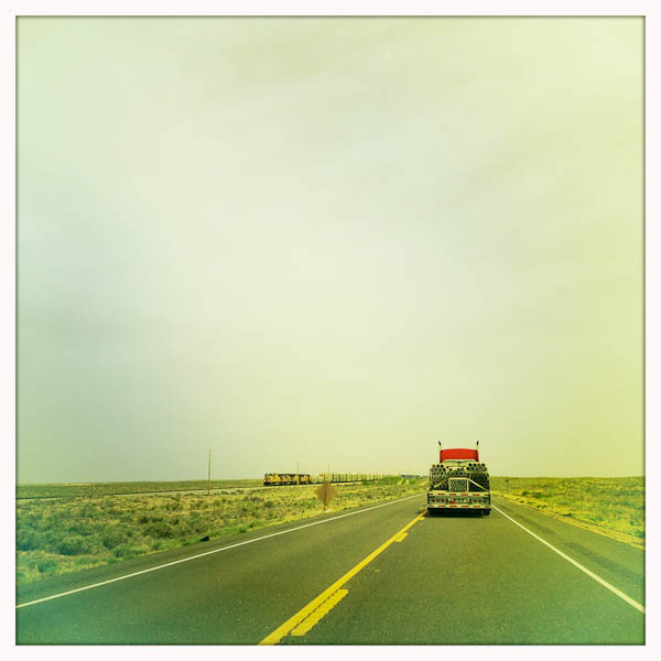
Trucks and Trains Across the Plains

New Mexico, Trucks, and Trains

Trucks and Trains ©2012 Bo Mackison

The whole object of travel is not to set foot on foreign land; it is at last to set foot on one’s own country as a foreign land. ~ Gilbert K. Chesterton

When I travel and I am the passenger, not the driver, I jot down a log of the trip. Filled with facts and figures, sure, so I can tabulate the trip costs but also filled with mumblings and questions and observations, and, in capital letters for emphasis, I note the places I would like to explore further.

Then, in an amazing feat of organizational skills typically not found at my level of expertise, I actually return to these notes when I plan another trip. Since there are only a few trusted routes from my Midwestern home to my Tucson home – at least when winter weather can ruin travel plans – we seem to travel some of the same roads.

A few of the highlights, thus far:

Left Illinois at 4:04 am, crossed the Mississippi at 4:08. Wonder what the people who have always lived in the arid west, those who have never seen large rivers but only banks that run dry (except when filled with Monsoon seasonal rains) would think of a wide river like the Mississippi. Always tumbling over itself in order to get to the Gulf of Mexico as fast as it can.

Missouri. First stop: Ayers for coffee. 4:10 am. Didn’t need gas but regular is $3.35.

4:15 am. “I am going on a trip to Arizona and I’m going to pack my ATTITUDE!” My good attitude – that’s half the key to good travel. Maybe more.

Palmyra, MO: Flashing signs on four lane highway. WATCH FOR FARM VEHICLES. HARVEST SEASON. Gas is $3.23.

Orion’s lights are brightly shining, lighting the sky. Rural house/barn lights are flickering on – early morning on the farm.

Monroe City, MO: Birthplace of Mark Twain. I didn’t know that! I’ve been to his boyhood home and all the other Twain sites in Hannibal a dozen times, but never knew his birthplace was another 20 miles away.

South River
North River
Salt River
Mussel Fork
Turkey Creek
Muddy Creek
Locust Creek
Higgin’s Ditch

5:05 am Clouds moving eastward. Stars are disappearing. Windy – the flags, and there are many, are standing straight out (at attention!)

Bevier, MO  Driving past we see that regular gas is $3.14
Ethel, MO No place open for breakfast.
Lingo, MO No place open for breakfast.

Exit to General Pershing’s Boyhood home Hmm.

Exit to Locust Creek Covered Bridge. Too bad it’s still dark.

Hickory Creek
Parsons Creek
Muddy Creek
Medicine Creek
Leeper Creek
Blackwell Creek

billboard: KO THE FAT. What the heck? Oh, Sherpa explains it means “Knock out” the fat. Of course.

In Chillicothe, MO. We try 3 different coffee shops — all either closed or they have disappeared. Get gas and bananas. Gas is $3.10. It is the HOME OF SLICED BREAD. Must Google later. Chillicothe looks like a nice town. There are quite a few murals on buildings of the main streets — still too dark for photos. Sigh!

Raccoon Creek
Grand River
Brushy Creek
Shoal Creek

6:45 am. Dawn and now there is light so we can see. And there’s a place for breakfast just ahead . . . to be continued sometime after breakfast..

————-

Bo Mackison is a photographer and the owner of Seeded Earth Studio LLC. She loves travel logs.