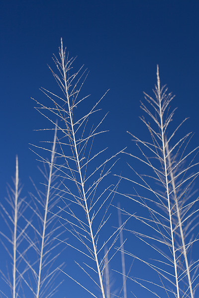
Yucca Candelabra

Yucca Candalabria

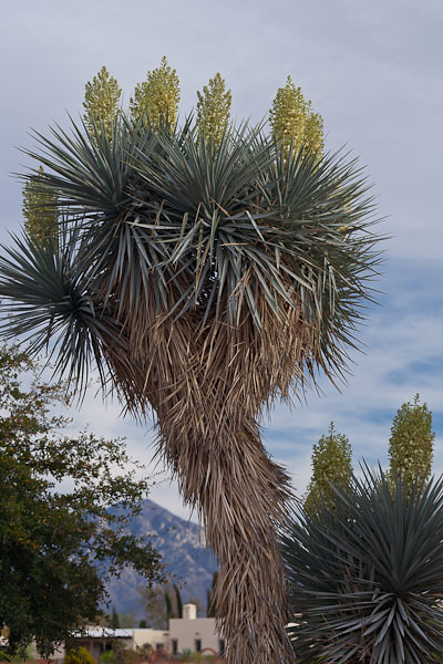
go site Yucca candelabra © 2012 Bo Mackison

https://opponix.com/fmarej9 Knowledge was inherent in all things. The world was a library and its books were the stones, leaves, grasses, brooks . . . We learned to do what only the students of nature ever learn, and that was to feel beauty.    ~ Luther Standing Bear

follow site Yuccas are a common plant in the United States Southwest, so common that it is the state flower of New Mexico.

https://www.iql-nog.com/2025/01/19/qrj4ezuf The leaves of the Yucca are long, narrow, and come to a sharp point. (I have proof – deep scratches on my arms. When will I learn!!)

go to site Fibers of the yucca can be used to make rope and loosely woven textiles. The thick root can be beaten into a lathery pulp which is then used for soap and shampoo. It was a plant that was frequently planted near homesteads and encampments for its usefulness.

Valium Order Online Uk When the yucca blossoms, creamy-colored, bell shaped flowers hang in loosely arranged clusters. If the flowers are pollinated, seed-filled capsules develop. The yucca then dies after flowering and fruiting, but produces offshoots that spread out from the mother plant and develop into new plants.

see The yuccas only known pollinator is the yucca moth. The female yucca moth has a specialized mouth to collect the pollen.  She lays her eggs in the yucca flower and covers the eggs with a ball of pollen. The pollen fertilizes the seeds which then begin to develop. The moth’s larvae require the yucca seeds for growth and development. Both species, the yucca and the yucca moth, benefit from the exchange. This inter-dependence on each other for survival is termed mutualism.

Cheapest Valium Online Uk It is quite a lovely thing, to walk or drive down nearly any street and see the yucca blossoms swinging high in the air, atop the yucca stalk.

Buy Diazepam Xanax ————–

click here Bo Mackison is a photographer and owner of Seeded Earth Studio LLC, living and photographing in southern Arizona. She is happy to see  so many plants in bloom.
Hiking Sabino Canyon

Yipes Stripes

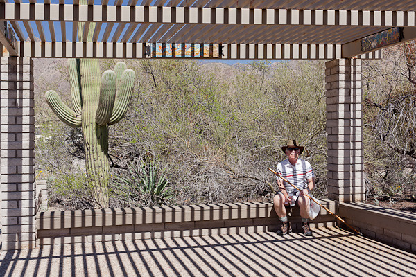
Order Tramadol Online Cod Yipes Stripes © 2012 Bo Mackison

go On a sunny, 80˚ day in March, Sherpa and I agreed it was a great day for a hike, especially a hike that had a bit of a cheat to it. We hiked the Phoneline Trail in Sabino Canyon, a gorgeous canyon in the Santa Catalina Mountains bordering Tucson. Our cheat was this — we paid a few bucks each for a ride on the shuttle which comfortably took us from the Sabino Canyon Visitor Center to the top of the line, stop #9. We figured once we were up on the mountain, it would be an easy hike down.

https://www.frolic-through-life.com/2025/01/s3xjv3f I love this photo of Sherpa with the many variations of stripes. Stripe shadows, stripes from the ramada on Sherpa’s shirt, and he’s even wearing a shirt with horizontal stripes. “Yipes, stripes” is right. I was seeing stripes for most of the shuttle ride.

End of the Shuttle Run

https://www.saiidzeidan.com/h8l9l05 End of the Shuttle Run © 2012 Bo Mackison

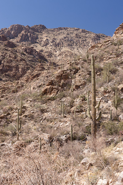
go to link As the tram takes you deeper and deeper into the canyon, the world of natural beauty feels immense. Towering mountains, rocky ledges, saguaro reaching up. This is another sky island, once of several dozen in southern Arizona and northern Sonora, Mexico. Desert at the lowest levels, a juniper, pine, and rocky habitat at the top.

https://www.mckenziesportsphysicaltherapy.com/0gv52prgu2y This trail starts at the end of the paved road. A half mile climb of ever-upward-reaching switchbacks takes us to the main Phoneline Trail. Once there, the trail follows the road, only several hundred feet higher. It isn’t a hard hike, but there are gentle ups and downs throughout the “descent” and several hundred boulders to help you climb up or climb down.

The Peak

https://www.rmporrua.com/i0jo2dxn8z The Peak © 2012 Bo Mackison

http://foodsafetytrainingcertification.com/food-safety-news/xu6iz1zul Once we climbed high enough, we could look to the north and see Mount Lemmon, the highest mountain peak in the Tucson area. If we had been really ambitious — and 30 years younger — perhaps we would have climbed up and over. But since neither the ambition or the age was happening, we took a lot of long looks from the trail we were on.

Eye Level with a 40 Foot Tall Saguaro

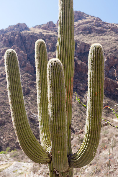
Tramadol Online With Mastercard Eye Level with a 40 Foot Tall Saguaro © 2012 Bo Mackison

https://www.acp-online.org/image/buy-valium-diazepam-10mg.php There is one tricky thing about hiking on a desert oasis on a mountain trail. The saguaro are conveniently within grabbing distance if one was to lose their balance. I started to reach out for a steadying cactus arm more than once before I realized what I was doing and quickly pulled away. This saguaro was a forty footer, but at my eye level on the trail I could see the upper third in great detail. Wow! Imagine what it will look like in another month, full of white cactus blooms.

Switchbacks on the Sabino Canyon Trail

follow link Switchbacks on the Sabino Canyon Trail © 2012 Bo Mackison

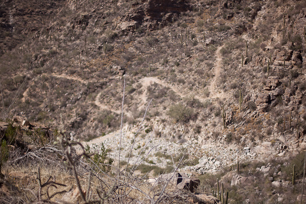
https://thelowegroupltd.com/2j258rm5 We looked back and laughed when we saw the trail we had just hiked, snaking up and down, switch-backing a mere 200 feet in elevation in a half mile.

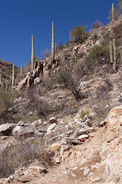
It Seems the Trail Always Climbs Uphill

source It Seems the Trail Always Climbs Uphill © 2012 Bo Mackison

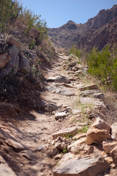
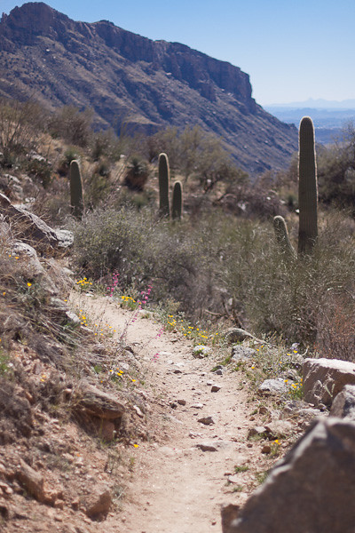
https://bettierose.co.uk/ignhgc668uv Rocks, rocks, and more rocks. Careful here to not trip and stumble, as the fall would be a long one. Since this area had a foot of snow earlier this week, the trail was bordered by lots of green — bushes, trees leafing out, wildflowers everywhere.

Wildflowers Along the Trail

Wildflowers Along the Trail © 2012 Bo Mackison

We both had had our exercise for the day when we reached the picnic area near the Visitor Center. And let me say — my peanut butter and strawberry jam on thick whole wheat never tasted better. And that cold bottle of water — perfect!

———–

Bo Mackison is a photographer and owner of Seeded Earth Studio LLC, is living in southern Arizona,  photographing and hiking the sky islands and giving thanks that she can see such sights.


Mexican Tree Flower

Mexican Tree Sunflower

Mexican Tree Sunflower © 2012 Bo Mackison

Nature can be trusted to work her own miracle in the heart of any man whose daily task keeps him alone among her sights, sounds and silences. ~ Gene Stratton Porter

—————

Bo Mackison is a photographer and owner of Seeded Earth Studio LLC, living and photographing in southern Arizona. She had never seen a sunflower tree until last week, but now she has.

Buenos Aires National Wildlife Refuge

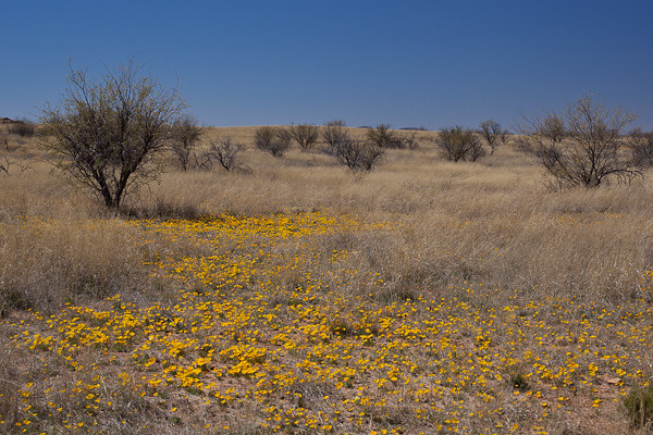
Buenos Aires Grassland

Buenos Aires Grassland © 2012 Bo Mackison

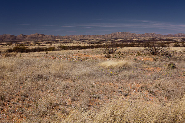
Buenos Aires National Wildlife Refuge in southern Arizona is 118,000 acres of grassland, mountain ranges in the background, riparian corridors rippling through the land. The habitat, a semi-arid grassland, is land of the masked bobwhite quail and pronghorn antelope, both of which are being re-introduced in the region. Grasses once filled the Altar Valley, and are now maintained and restored by prescribed burns.

The Pleasures of Simplicity

The Pleasures of Simplicity © 2012 Bo Mackison

In the 1800s, Altar valley was open grassland. Pronghorns had free range, falcons and hawks filled the air with their swooping, gliding, and soaring.  Mexican wolves, black bears and jaguars roamed in the grasses, traveling the corridors between the mountain ranges.

Poppies at Buenos Aires NWR

Poppies at Buenos Aires NWR © 2012 Bo Mackison

Then the Valley began filling with small towns and ranches in the 1860s, and the delicate balance maintaining the ecosystems gradually suffered. As ranchers expanded and grazing bared much the grasslands and exposed the land to the monsoon rains, erosion of the barren soils quickly followed.

With the grass gone and natural fires suppressed, mesquite gained a foothold. The grassland no longer supported the masked bobwhite quail or aplomado falcon. Pronghorn, wolves, bear, and jaguar were hunted or trapped.  Lehmann’s lovegrass, a non-Native grass, was introduced in the 1970s to help stop erosion. But this poor substitute for native grasses and now considered an invasive species, did nothing of benefit.

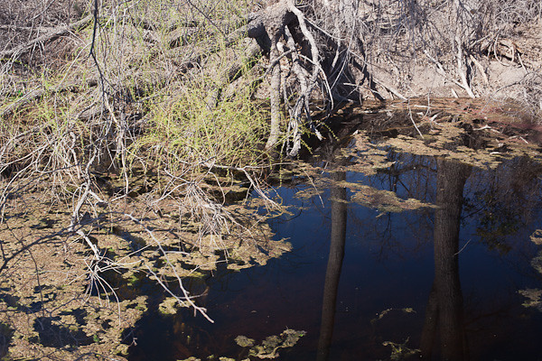
 Spring in Arivaca Cienega

Spring in Arivaca Cienega © 2012 Bo Mackison

Buenos Aires National Wildlife Refuge was established in 1982 to re-establish the grasslands habitat and protect the Arivaca Cienga ( spring fed marshy area) and the Arivaca Creek and its watershed, and important resource for the several hundreds of kinds of birds that either live in the region, migrate through, or winter over.

The area is again lush with grasses. The wildflowers are abundant — Mexican poppies turn areas golden with bright color, purple bunches of Verbena add contrast.

A beautiful place, an important resource to protect and preserve.

—————-

Bo Mackison is a photographer and owner of Seeded Earth Studio LLC, living and photographing in southern Arizona. There are days Bo wanders the roads and imagines pronghorn ranging, wild and free.

A Drive through Box Canyon, Sky Island View

Open Space

Open Space © 2012 Bo Mackison

The Box Canyon Road passes through the norhthern part of Madera Canyon from Arizona Highway 83, north of Sonoita, to White House Canyon Road, near the entrance to the Madera Canyon Recreation Area. This road was built in the 1930s by the Civilian Conservation Corps which was also responsible for building some of the original roads in Madera Canyon, and the original campgrounds, bridges and hiking trails.

The road passes through range land for several miles,. Horses are grazing behind secure fencing and cattle are both grazing on the ranch land and wandering on the roads. (Sorry – no pic. I was driving, well, skirting around cows in the middle of the road!)

Sky Island Layers

Sky Island Layers © 2012 Bo Mackison

The road eventually hugs the mountain side and climbs upward, offering views of the layers of sky island habitats. Here, a riparian corridor including sycamores and cottonwoods a leafy green near the river bed, though the river is dry. In the higher elevations, a mixture of evergreen oaks, Alligator junipers and Pinions are in the oak-pine woodland. The furthest peaks are covered with Douglas fir, Gambel oaks, maples in the middle elevations,  white fir and a few aspens at the highest elevations.

Road, Vintage CCC

Road through the Canyon, Vintage CCC © 2012 Bo Mackison

The dirt road clings rather snugly to the rising topography, but the views are beautiful. If you want to get a good look at the scenery and snap a few photos, one either needs to stop frequently — there are a few wide spots, but otherwise the road is lightly traveled and visibility is good. I could always see if cars or trucks were driving towards me or following me, so I often stopped mid-road, but I was VERY careful! Another option, and the one I recommend, is having both a driver and a passenger/photographer so that the roles are well defined.

If you look far in the distance, in the valley between the Santa Ritas, one are looking at Green Vally and Continental , Arizona, small towns south of Tucson, and beyond the towns, on a very clear day, you can make out eh multiple observatories on Kitt Peak, 70 miles away.

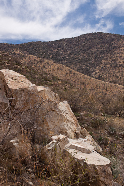
Rocky Seat

Rocky Seat, Long View © 2012 Bo Mackison

I love the rippling habitats of the sky islands. I sat on this rock formation for awhile, very comfy, and took a few notes, snoozed a few minutes — it was so warm and I swear the sun sang me a sweet sunny lullabye — and did a few sketches. I am practicing a few plein air techniques with some basic supplies — pencils, colored pencils and watercolors, but they are definitely in the practice stage at this point.

Green Lichen on Rocks

Green Lichen Colony © 2012 Bo Mackison

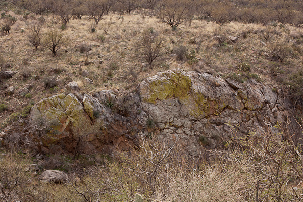
These rocks, and many of the rocks throughout the sky islands in southern Arizona and northern Sonora, Mexico, are covered with a lime green living crust called lichen. Lichen is a multiorganism, part fungus, part either green algae or blue-green algae. (The fungus is the house; the algae provides the nutrients. Lichen can grow in the most hostile places, including bare rock in cold places.

The amazing thing about lichen is that it is not scientifically classified as either a plant nor an animal. DNA analysis shows lichen is very different from a fungal make-up, which is in the animal kingdom, but it is also very different from the algae make-up which belongs to the Bacteria kingdom.A sort-of combination of animal-bacteria, but not a plant.

I guess lichen has a kingdom all its own.

See the Road Constructed by the CCC?

See the Road Constructed by the CCC? © 2012 Bo Mackison

On the way out of the canyon, I crossed a bridge, and was able to take this photograph of a dry rocky wash which appears to now be the home of lots of prickly pear (more on the edges, not in the middle sandier area.)

Out of the Mountains

Coming Out of the Mountains © 2012 Bo Mackison

And leaving the mountain pass, I came out into another thorn scrub with quite a few prickly pears, yucca, and barrel cacti spread amidst the mesquite. The cattle guards appeared on the road again and I noticed signs for open range. I didn’t see any roaming cattle on the west side of the pass, but they had been on the road earlier in the day.


How Many Habitats can you See?

How Many Habitats Can You See? © 2012 Bo Mackison

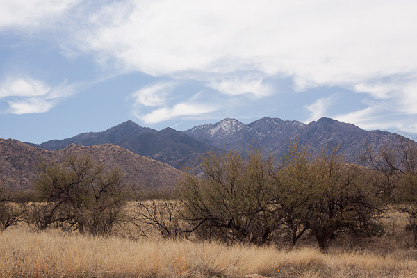
And finally, I reach the road that leads away from the Santa Ritas. I pulled off on the side of the grasslands, and took one last photograph of the Santa Rita Mountain Range and its highest mountain, Mount Wrightson (9453 feet).

I think it takes me about twice as long to take the shortcut through the mountain pass compared to taking Arizona Highway 83 north to Interstate 10 West, drive through Tucson, and then take Interstate 19 south to Madera Canyon. But the shorter drive, though interesting and with great views at times, just can;t compare to a mountain pass drive through the Santa Rita Wilderness. (And a some ranch lands at the beginning and end — just to add a bit more variety, I suppose…)

—————–

Bo Mackison is a photographer and owner of Seeded Earth Studio LLC, living and photographing in southern Arizona. There are days the wanderlust bug bites Bo and then she wanders the roads to see what she can see.